Wednesday, July 2, 2014

Sand mining is going to be new battleground.


Illegal and indiscriminate river sand mining is going to cause a large number of environmental and social problems in World.

By
Dr. Nitish Priyadarshi
Geologist.

 This is Kanchi river which provides sands to Ranchi district.


 This is Jumar River near Ranchi which now contains less sand deposit due to over exploitation.


Illegal sand mining is a scourge in states across India. The latest battle in Gautum Buddh Nagar, Uttar Pradesh, where sub divisional magistrate (SDM) was suspended from service, has served to highlight the plight of rivers ravaged.

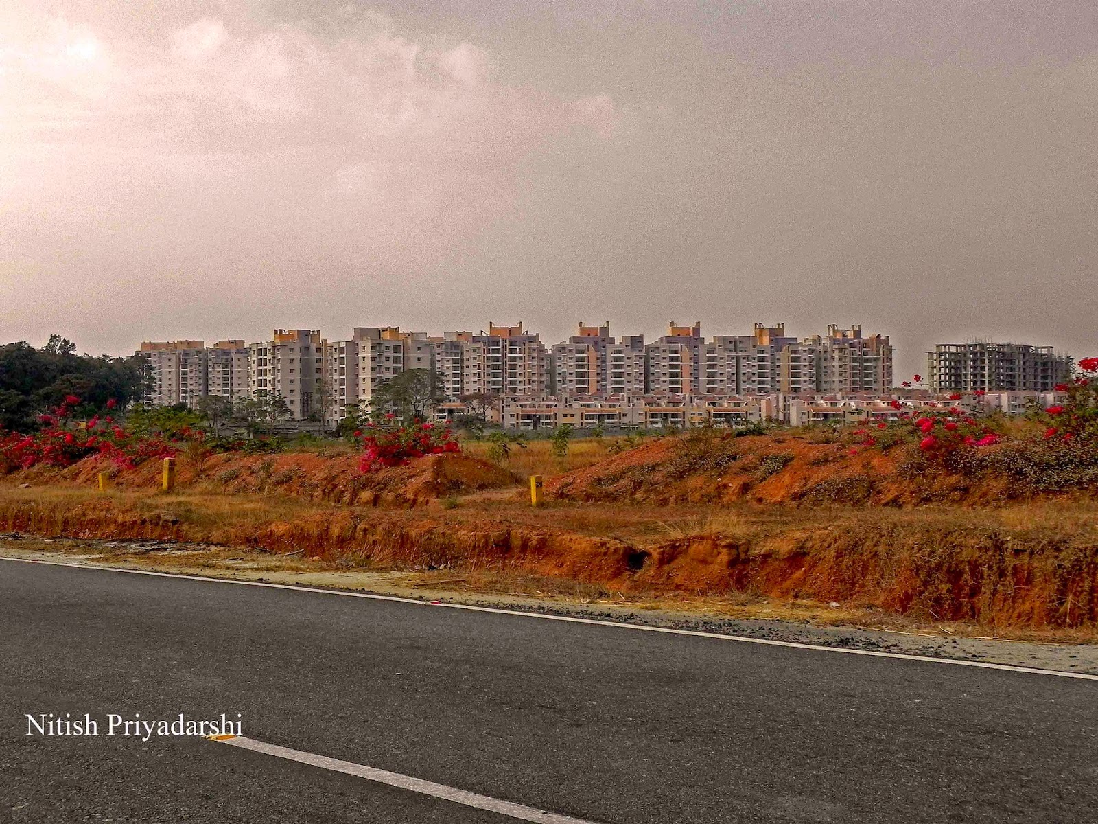
Construction work on projects worth thousands of crores of rupees in Jharkhand has been affected by a sand crisis caused by the on-again, off-again auction policy.

River sand is a product of natural weathering of rocks over a period of millions of years. It is mined from the river beds. River sand is becoming a scarce commodity now. River (Fresh water) sand is far superior for construction purposes than any other sand used in construction.

Due to the crisis, prices of river sand have gone up to Rs.7,000 per truck from Rs.3,000 per truck before the current round of auctions started and then halted due to protests. This is because the raw material has to be brought from outside the state.

It is unfortunate that the Jharkhand state is facing a sand crisis and projects worth more than Rs.3,000 crore have been affected. This crisis has been created by the state government. It is the duty of the state government to facilitate licenses and environmental clearances. Construction work has been badly affected in the state.

Illegal sand mining is adding to the plight of the Yamuna river in the National Capital Region. It has not only changed the course of the river but also made its riverbed unstable, thus disturbing the biodiversity of the region.

While farmers from nearby villages claimed that people involved in illegal sand mining intentionally prevent the natural flow of water to take out more sand from a spot, experts claimed that it actually leads to change in the course of river.

The Karnataka government has attempted a rare balancing act between the needs of rivers and buildings for sand. This conflict between the environment and development was addressed by issuing an order to the public works department (PWD) on September 16, 2013 mandating the civil body to use only manufactured sand (M-sand) instead of river sand for all its building activities. A move widely seen as a good initiative aimed to plug the demand-supply deficit in order to ease pressure on sand mining. Shifting of PWD, one of the major consumers of sand in the state, to M-sand is bound to ease prices of sand in the market and also curb illegal sand mining. Point to be noted here is that M-sand is nothing but crushed rock, that too mostly granite. Though it yields higher quality concrete, but the questions one needs to ask are these: Are we really solving the environmental concerns? Isn’t it a misplaced attempt as rocks are also minerals that need to be conserved?

As humans we’re a race that takes everything for granted, and that’s evident in the way we’ve recklessly consumed most of our natural resources. Take a look around, we haven’t spared much in the name of development. Whether it’s coal, water, oil or even natural gas, we’ve managed to diminish it all. But did you know that sand falls into this list as well? That it’s an extremely essential natural resource being used everywhere, right from cement, concrete, glass, computer parts, smart phones, toothpaste, cosmetics, paper, paint, tires and so much more! But sand isn’t an unlimited resource. It’s in fact one of the most consumed and underestimated resources in the world and with 70 per cent of world beaches disappearing, we haven’t the slightest idea what the repercussions will be in the future.

Ranchi city in Jharkhand State receives sand from only Kanchi river now. Earlier sands of two more rivers were used for construction. Now in both rivers the deposits of sands have been affected due to over exploitation especially of Jumar river flowing north of city. 

Sand being so in demand (it’s fuelling the construction boom everywhere), the industry has already consumed most of it available in quarries and rivers. Sand from the deserts cannot be used for construction as the grains are rounded and polished (due to winds) and do not stick together, which is essential for construction. The industry has no option and is turning to the sea and beaches to meet its insatiable demand. Illegal sand mining is already underway in 70 countries around the world.

Sand-rivers providing perennial water supply some sand-rivers provide water throughout all the years due to the favourable features of:

• The floor under the sand in a riverbed forms an upwards dyke which traps water upstream of it. An underground reservoir is thereby created from where water can be drawn. In Jharkhand state of India people residing near the banks of polluted Damodar and Swarnarekha River are more dependent on river sands for drinking water than consuming directly from the river. They dig the sand to trap clean water.

• Coarse sand and gravel in sand-rivers can trap and store 50 per cent of water in the voids between the solids of sand. Up to 35 per cent of this water can be extracted. In other words, 350 litres of water can be extracted from every cubic metre of sand.

Sand is not a sustainable resource and though it regenerates, it is being consumed faster than its  rate of creation. It takes 25,000 years to create sand from the mountains and sand stone, which breaks down and flows down little streams, down rivers to deltas and then gets carried to the ocean by the waves and tides. Much of the sand never makes it to the ocean because of dams which trap the sand. There are about 8,45,000 dams in the world. In the US alone there are around 80,000 dams. In China, it is estimated that by 2020 not one river will reach the sea. Thanks to these dams, much of the sand that could reach the sea won’t do so.

Most of us think of sand as a necessary ingredient for any beach vacation. Yet those seemingly insignificant grains of silica surround our daily lives. Every house, skyscraper and glass building, every bridge, airport and sidewalk in our modern society depends on sand. We use it to manufacture optical fiber, cell phone components and computer chips. We find it in our toothpaste, powdered foods and even our wine (both the glass and the wine, as a fining agent)! Is sand an infinite resource? Can the existing supply satisfy a gigantic demand fueled by construction booms? What are the consequences of intensive beach sand mining for the environment?

By the end of the 21st century, beaches will be a thing of the past. That is the alarming forecast of a growing number of scientists and environmental NGOs. Sand has become a vital commodity for our modern economies. The worldwide construction boom fuelled by emerging economies and increasing urbanization has led to intensive sand extraction on land and in the oceans, with damaging environmental impacts.
The construction industry requires massive amounts of sand for its projects.  Despite some legal framework prohibiting sand mining in most states, the industry gets most of the sand by dredging rivers’ earthen materials beyond a safe capacity.   In almost every river where it is viable, the ‘sand mafia’ purge the depths for profitable sand, amounting to an illegal yearly turnover of Rs. 1000 crore.   Despite its illegality, sand mining is perpetuated by various social and economic dilemmas.  First, it brings revenue to state government and panchayats, which paves the way for corruption and conflict.   Thus, relationships between local politicians, contractors, and bureaucrats emerge to create a power nexus capable of deterring community-based resistance.   The players in this nexus are infamously termed the’ sand mafia,’ by the media. 

The case of Maharashtra epitomizes this phenomenon.   In September 2010, the Bombay High Court banned the extraction of sand, due to its adverse environmental effects and detriment to water supply.  If this ruling had stuck, the real estate industry would have suffered a loss of Rs. 2,000 crore.   The High Court asked the government to come up with a new policy on sand mining after the court appointed Indian Institute of Technology submitted a report. On 20 Oct 2010, State cabinet approved a new sand mining policy that empowers communities to have a say on sand mining in their localities. The policy also bans use of suction pumps in dredging but fails to ban mechanized dredging. Moreover, the High Court directed the Maharashtra government not to award any contract or allow any sand excavation to commence across the state "until and unless" it first obtained environmental clearance as contemplated in its latest policy decision.

The environmental reasons for this ban and others across India are numerous. Sand acts as an aquifer, and as a natural carpet on the bottom of the river.  Stripping this layer leads to downstream erosion, causing changes in channel bed and habitat type, as well as the deepening of rivers and estuaries, and the enlargement of river mouths.    As the river system lowers, local groundwater is affected, which leads to water scarcities aggravating agriculture and local livelihoods.  In terms of legal measures, ground water shortages have been noted as the patent problem with river sand mining.  Less considered in legal action, but centrally relevant, experts also note substantial habitat and ecological problems, which include “direct loss of stream reserve habitat, disturbances of species attached to stream bed deposits, reduced light penetration, reduced primary production, and reduced feeding opportunities”. key issues have not been resolved.

The rivers in Kerala have been subject to significant such degradation, and serve as a good overview of the aforementioned problems.  Major rivers such as the Pampa, Manimala, and Achankovil have been subject to such non-discretionary dredging that there has been a sharp fall in ground water table levels.  According to one study, indiscriminate mining has lowered the Pampa an average of three to four metres, and up to six metres in some areas.

Sand smuggling is continuing unabated in Krishna district despite the ‘preventive measures’ by the official machinery since the sand mafia is enjoying the support of the politicos.

While the government stopped the sand auctions due to legal and administrative issues as well as pressure from the politicos for more than a year, the sand mafia is minting money by transporting the sand from Krishna river using trucks, mini trucks, passenger auto-rickshaws and even bullock carts on both sides of the river Krishna in Krishna and Guntur districts.

Nearly 40 sand reaches are located along the Krishna river in the district from Jaggaiahpet mandal upstream of Prakasam barrage to downstream of the river in Avanigadda mandal in Diviseema.

Sand smuggling is a regular phenomenon in Ibrahimpatnam, Kanchikacharla, Nandigama, Chandarlapadu, Jaggaiahpet, Penamaluru, Thotlavalluru, Challapalli, Ghantasala, Pamarru and Avanigadda mandals of Krishna district.

Besides, sand is also smuggled from rivulets of Munneru and Tammileru in Krishna district.  The officials are facing a challenging task of preventing the illegal sand quarrying. Most of the illegal sand extracted from the reaches is used for construction activity particularly in the construction of buildings, houses, and government projects.

In the Eastern Uttar-Pradesh, mechanized sand mining has resulted in soil erosion and turned thousands of acres of land infertile and sand mafias are in control of rivers like Chhoti Gandak, Gurra, Rapti and Ghaghara.

Indiscriminate sand extraction is likely to create environmental problems in future. The contractors who get the rights for quarrying are exceeding their limits in extracting more sand deep into the river beds.
This will create many environmental problems in future.

Collins et al. (1990) summarized the effects of sand and gravel mining as listed below:

a) Extraction of bed material in excess of replenishment by transport from upstream causes the bed to lower (degrade) upstream and downstream of the site of removal.

b) Bed degradation can undermine bridge supports, pipe lines or other structures.

c) Degradation may change the morphology of the river bed, which constitutes one aspect of the aquatic habitat.

d) Degradation can deplete the entire depth of gravelly bed material, exposing other substrates that may underlie the gravel, which could in turn affect the quality of aquatic habitat.

e) If a floodplain aquifer drains to the stream, groundwater levels can be lowered as a result of bed degradation.

f) Lowering of the water table can destroy riparian vegetation.

g) Flooding is reduced as bed elevations and flood heights decrease, reducing hazard for human occupancy of floodplains and the possibility of damage to engineering works.

h) The supply of over bank sediments to floodplains is reduced as flood heights decrease.


i) Rapid bed degradation may induce bank collapse and erosion by increasing the heights of banks.

j) In rivers in which sediments are accumulating on the bed (aggrading) in undisturbed condition, gravel extraction can slow or stop aggradation, thereby maintaining the channel's capacity to convey flood waters.

k) The reduction in size or height of bars can cause adjacent banks to erode more rapidly or to stabilise, depending on the amount of sand and gravel removed, the distribution of removal, and on the geometry of the particular bend.

l) Removal of gravel from bars may cause downstream bars to erode if they subsequently receive less bed material than is carried downstream from them by fluvial transport.

A worldwide sand rush is taking place. Sand is bagged by divers on the Maldives, it is towed from beaches to trucks by mules in Morocco, excavated from heavenly beaches by machines in the Philippines. In Indonesia dredge boats suck it up from the bottom of the sea, in Vietnam from the river Con. In Sierra Leone workers excavate every grain from local beaches, while on the other side of the Atlantic, in the Caribbean, sand thieves steal entire beaches unnoticed.

Sand is a key raw material for the construction business. Building requires tons of sand. Armoured concrete is two-thirds sand. The construction of a house costs on average two hundred tons of sand. Thirty thousand tons are needed for a one-kilometre stretch of motorway; twelve million tons for a nuclear plant. After water, sand is the most-used material in the world.

Sand for Construction

Sand is an extremely needful material for the construction but this important material must be purchased with all care and vigilance. Sand which is used in the construction purpose must be clean, free from waste stones and impurities. It is important to know what type of sand is beneficial for construction purpose as sand is also classified into three different forms that make it suitable for specific type of construction.

Sand is classified as: Fine Sand (0.075 to 0.425 mm), Medium Sand (0.425 to 2 mm) and Coarse Sand (2.0 to4.75 mm). However this classification of sand is further has types of sand in particular and on that basis only they are being incorporated in the construction. Read out the detailing of the types of sand:

Pit Sand (Coarse sand)

Pit sand is classified under coarse sand which is also called badarpur in common language. This type of coarse sand is procured from deep pits of abundant supply and it is generally in red-orange colour. The coarse grain is sharp, angular and certainly free from salts etc which is mostly employed in concreting.

River Sand

River sand is procured from river streams and banks and is fine in quality unlike pit sand. This type of sand has rounded grains generally in white-grey colour. River sand has many uses in the construction purpose such as plastering.

Sea Sand

As the name suggest, sea sand is taken from seas shores and it is generally in distinct brown colour with fine circular grains. Sea sand is avoided for the purpose construction of concrete structure and in engineering techniques because it contains salt which tends to absorb moisture from atmosphere and brings dampness. Eventually cement also loses its action when mixed with sea sand that is why it is only used for the local purpose instead of structural construction.

There are different standards for the construction purpose which must be checked and considered for the better construction. The requirement according to which sand is chosen should be like:
  • For plastering purpose the overall fine sand used must not be less than 1.5 while silt is preferred to not less than 4 percent.
  • For brick work fine sand used must not be less than 1.2 to 1.5 and silt is preferred is 4 percent generally.
  • Concreting work require coarse sand in modulus of 2.5 to 3.5 with not less than 4 percent silt content.
The coarse sand is used for constructing pillars and underground tanks, while the medium sand is used for the first layer of plastering and other works. The final finish of plastering includes the use of fine sand. Pit coarse sand obtained from quarries is used in the construction of houses in urban areas of Hyderabad. It is filtered when required for specific uses in construction such as plastering.

Like any other material, there are certain features that determine the quality of sand. Good quality sand should not possess more than 4% of silt content. It should have natural and crushed stone sand. It must be free from organic matter and other dirt particles.

How to check the quality of sand.

Many of us do not know the quality, features, and measurements of good sand. Many builders/suppliers make an advantage of this by providing a cheap rate load and may tell that it is of good quality. However, there are certain ways which help you in knowing the quality of sand. Take some quantity of sand and put it in a glass of water. Shake it well and allow it to settle. If a distinct layer of clay or impurities is formed at the top of the sand, it can be considered as of low quality. The other way of assessing the quality is to add sodium hydroxide or caustic soda to sand solution. The presence of impurities in the sand is detected by the color change of the solution. Clay and silt content present in the sand also affects its quality. Here is another idea for assessing the quality of sand. When you rub the sand sample between damp hands, clean sand will leave the hands slightly stained. If the hands are left dirty, it indicates the presence of too much silt or clay in the sand.

Dwindling sand supplies, rising prices and an increased demand have given rise to a sand mafia. In many countries criminals collaborates closely with corrupt governments and police. In over 8,000 places in India, for example, sand is excavated illegally.

Forty percent of Morocco’s sand trade involves illegal sand that is excavated and immediately sold on construction sites. There, it is used unprocessed to make concrete, a guarantee for future problems. The Moroccan government fears that most of its country’s beaches are being transformed into a moonscape.

World status:
 
Singapore – With a booming economy, it has been accused of importing illegally dredged sand from neighbouring states and smuggling sand from poorer neighbouring countries to expand its coast line.

Many islands of Indonesia have vanished.

USA- Sand mining in the USA has resulted in erosion and a collapse of beachfront houses and properties. With beaches disappearing, many places like Florida are artificially putting sand back onto the beaches to attract tourists, but this not been fruitful

Maldives – Many islands have disappeared, there’s been a loss of livelihood and rising water levels Dubai has extensively used and extensively exhausted its own sand resources to build artificial beaches  and in construction, etc. Dubai and many other such countries are buying and importing sand. 

India -
After China and the United States, India has the world’s largest construction business.

India has a very strong sand mafia which works in nexus with builders and politicians, especially in areas like Navi Mumbai, and coastal districts of Thane, Raigad, Sindhudurg and Ratnagiri and Gujarat and Goa. Sand mining and dredging is rampant despite all directives against it.

A lack of any clear regulatory framework has aggravated the environmental problems caused by river sand mining. In addition, sand prices have increased several times over in recent years and this has driven the exploitation of sand into fragile and remote places. This movement of sand mining into marginal areas has not only exacerbated its impact on nature, but has also caused more damage to weak rural roads.

If the demand for sand could be partly met from other sources the environ­mental impact of river sand mining could be significantly reduced. To see whether this is a possible course of action, alternatives to river sand mining were identified and assessed. The following alternative sources were highlighted: offshore sand, land ­based sand, dune sand and the use of quarry dust. A river sand tax could also be introduced in order to encourage the construction industry to move towards the use of offshore sand. But sustainable mining is best option to protect the sands from over exploitation because till today alternatives of sand is not available.

Mother Nature has its own way to counter coastal erosion via a natural supply of sand. Most beach sand comes from rivers that bring it in from the mountains. But exactly these rivers are being dammed up. That effectively stops the migration of sand. Worldwide dams are stopping the supply of fresh sand and are holding up one quarter of the sand supplies. River dredging is another cause why half the sand that would normally reach the sea doesn’t succeed in doing that.

References: 

Collins,B. and Dunne,T. (1990). Fluvial Geomorphology and River-Gravel Mining: A Guide for Planners, Case Studies Included. Special Publication 98, California Department of Conservation, Division of Mines and Geology.


Wednesday, June 18, 2014

Problems of Urban growth.


With special reference to Ranchi city, India.

By
Dr. Nitish Priyadarshi.
Geologist.
76, circular road, Ranchi-834001
Email: nitish.priyadarshi@gmail.com


Night view of Ranchi city.

Abstract:

Owing to population growth, poor levels of hygiene, and increasing urban poverty, the urban environment in many developing countries is rapidly deteriorating. Densely packed housing in shanty towns or slums and inadequate drinking-water supplies, garbage collection services, and surface-water drainage systems combine to create favourable habitats for the proliferation of vectors and reservoirs of communicable diseases. Ranchi the capital city is expanding both vertical and horizontal resulting in lots of problem like irregular electric supply, water supply, ground water depletion, air pollution, noise pollution, municipal waste disposal, failure of drainage systems, traffic jams etc. Surface waters are being contaminated. Seasonal diseases have also multiplied.


Introduction:

As more and more people leave villages and farms to live in cities, urban growth results. Urbanization occurs naturally from individual and corporate efforts to reduce time and expense in commuting and transportation while improving opportunities for jobs, education, housing, and transportation. Living in cities permits individuals and families to take advantage of the opportunities of proximity, diversity, and marketplace competition.
People move into cities to seek economic opportunities. In rural areas, often on small family farms, it is difficult to improve one's standard of living beyond basic sustenance. Farm living is dependent on unpredictable environmental conditions, and in times of drought, flood or pestilence, survival becomes extremely problematic.

Cities, in contrast, are known to be places where money, services and wealth are centralized. Cities are where fortunes are made and where social mobility is possible. Businesses, which generate jobs and capital, are usually located in urban areas. Whether the source is trade or tourism, it is also through the cities that foreign money flows into a country. It is easy to see why someone living on a farm might wish to take their chance moving to the city and trying to make enough money to send back home to their struggling family.

There are better basic services as well as other specialist services that aren't found in rural areas. There are more job opportunities and a greater variety of jobs. Health is another major factor. People, especially the elderly are often forced to move to cities where there are doctors and hospitals that can cater for their health needs. Other factors include a greater variety of entertainment (restaurants, movie theaters, theme parks, etc) and a better quality of education, namely universities. Due to their high populations, urban areas can also have much more diverse social communities allowing others to find people like them when they might not be able to in rural areas.

Clearly, urban settlements differ greatly in size, as mentioned by their populations. Is there a Theoretical maximum and an optimum size? Criffith Taylor and others believe that the ultimate size may be fixed by the increasing difficulty of obtaining enough water to supply unduly large numbers concentrated in a small area, while Lewis Mumford and similar authors think that the continued growth of very large cities not only produces more administrative problems than benefits. This also paralyses rather than furthers social relationships and phenomenally raises central land values, so much that land ceases to be adaptable to new needs.

Views on the optimum size of a city have altered with the march of history. Plato believed that most desirable size was 5,000, a figure which would allow everybody to hear the voice of an orator and so participate in active political life and develop varied social relations. Late nineteenth – century garden city enthusiasts in Britain thought that towns of 30,000 to 50,000 would be large enough supply all necessary human needs, whether medical, educational, social, economic or cultural.

Towns could not come into being until the surrounding countryside was capable of providing a food surplus in the past. Due to modern transport and large surpluses in many parts of the world, towns generally have little difficulty in obtaining food, even from far distant lands. Developing countries may lack the capital to give all their town folk an adequate diet, and even in developed countries there are sporadic temporary shortages, owing to failures in economic planning, poor harvests, dock strikes and traffic hold-ups occasioned by excessive rain, snow, floods, droughts etc.

The problem of water supply is more permanent and applies specifically to cities. It is becoming increasingly serious even in advanced countries which certainly have no problem in paying for the water they consume. The root of the problem lies in the fact that 98% of the earth’s surface water is contained in the salt oceans and in ice-caps. The remainder is unevenly distributed and often polluted. Over half is needed for agriculture, about a third for industry, 10 percent for domestic use.

Many cities, especially in developing countries, lack a clean supply of fresh water. In India, e.g., less than a third of the urban population has access to pure water, and the main reason why water borne diseases are rampant. Even when people are provided with purified water for drinking, they usually wash themselves and their clothing in contaminated supplies.

Owing to population growth, poor levels of hygiene, and increasing urban poverty, the urban environment in many developing countries is rapidly deteriorating. Densely packed housing in shanty towns or slums and inadequate drinking-water supplies, garbage collection services, and surface-water drainage systems combine to create favourable habitats for the proliferation of vectors and reservoirs of communicable diseases. As a consequence, vector-borne diseases such as malaria, lymphatic filariasis and dengue are becoming major public health problems associated with rapid urbanization in many tropical countries

Another change that has occurred after the oil crisis of 1973 is the vertical growth of large cities. People who were living in suburbs found it costly to travel to the city. The open spaces within the city got filled up by the construction of high rise buildings. Large bungalows and old residences were demolished and high rise buildings have come up both as commercial complexes and as residential flats. Many rich families are migrating from the suburbs to flats or apartments near the city centre. The vertical expansion of cities poses further problems in water supply, sewage disposal and traffic congestion on the roads. Traffic causes urban noise, air pollution, stress and strain in an individual.

Urbanization results in construction of a large number of buildings, more roads factories, parking places, etc. for all these, land is secured either by diverting agricultural land or by cutting forests. There may not be one example where a large urban centre has been developed on barren land. It is always the agricultural land or forest land which is utilized. At some places beaches, lakes and rivers are filled to create land to accommodate the growing population. In these cases too, natural habitat is disturbed or destroyed.

Urbanization also introduces new types of plants and animals. When human beings occupy any area they prefer to those animals and plants which are of immediate value. For example, dogs, horses, cows and other domestic animals, are maintained. Parks and garden are created where plants of ornamental and economic values are cultivated. There is also another class of animals, which automatically start living in areas which are occupied by humans. There are rats, crows, mosquitoes, houseflies etc. 


The demands made on water by urban industries, power stations and homes are growing at a more rapid rate than the growth of population. Many wells do not yield enough water, river pollution, like Ganga, Damodar etc. in India, is a continuing evil, and the remaining water resources- mostly in thinly populated highland areas of abundant rain- are far from many consuming centres.

Objectives:

  1. To understand the problem of the Ranchi city due to population growth after becoming capital of Jharkhand state.
  2. To enhance equal and good environment planning on every aspect of development in Ranchi city.
  3. To create awareness of water contamination and water depletion.
  4. To examine the relationship between urbanization and climate change.

Methodology:

In order to achieve the purpose of this paper and to answer the research questions, information was gathered in several ways. These are: field interviews, and field observation . Secondary data also is an important source of information for this paper which was collected through local news papers and web sites.


Case study of Ranchi.


Ranchi is located in the southern part of the Chota Nagpur plateau, which is the eastern section of the Deccan plateau. Ranchi is known as the "City of Waterfalls" because of its numerous waterfalls, the most well known of which are Dassam Falls, Hundru Falls, Jonha Falls, Hirni Falls and Panchghagh Falls.
The Subarnarekha river and its tributaries constitute the local river system. The channels Kanke, Rukka and Hatia have been dammed to create reservoirs that supply water to the majority of the population.
Ranchi has a hilly topography and its dense tropical forests a combination that produces a relatively moderate climate compared to the rest of the state. Although Ranchi has a humid subtropical climate, its location and the forests surrounding it combine to produce the unusually pleasant climate for which it's known. Its climate is the primary reason why Ranchi was once the summer capital of the undivided State of Bihar and was designated a preferable "hill station". Since that time, rapid population growth and industrialization have caused a marked change in its weather patterns and an increase in average temperature. This has resulted in gradual loss of its eligibility for "hill station" status

Demographic history of Ranchi shows that its population grew slowly during 1901-1941. In the subsequent decade of 1941 and 1951, its rate of growth was higher than national average. Due to enhanced importance of the city and its environment, people are attracted towards the city, and occupy land for businesses and residential purposes. The decade 1961-1981 saw the highest growth of population due to migration and attraction of people towards the old summer capital of Bihar. Population increased with 82 percent in 1961-71 and 92 percent in 1971-81. Obviously, people occupied the area where they felt secure in terms of education, hospital, infrastructure, employment, etc.

Ranchi started as a small city occupying an area of around 6 sq km in 1869 with a population of approximately 12,000 in 1871. The area gradually increased to 43.44 sq km in 1965, 175.29 sq km in 1985 and eventually stood at 177.19 sq km in 2004.


Geographically Ranchi city is heterogeneous and due to its varied topological features, development process disturbs-land, village forests, and natural resources. Use of land and steep slopes for cultivation, and heavy engineering works can easily activate ecological degradation. Since natural resources are important base for subsistence, some means should be devised for planned use of these resources. Ranchi region needs much more attention due to regular occurrences of deforestation and improper urbanization.

Rapid urbanization has resulted due to several factors. However, natural population growth remains one of the major factors since 1980s.Ranchi City is experiencing a high rate of growth and it is one of the fastest growing cities in India. As per census from 1901 to 1941 the rate of growth was 3.5 percent per annum, whereas it was 14 percent during 1951 to 1971 and 8 percent during 1971 to 2001. After independence, population of Ranchi City in 1951 was only 1,06,849, which increased by over eight times to 8,63,180 in 2001.


After being separated from Bihar, Jharkhand state of India is now fast growing in terms of business. Ranchi the capital city is expanding both vertical and horizontal resulting in lots of problem like irregular electric supply, water supply, ground water depletion, air pollution, noise pollution, municipal waste disposal, failure of drainage systems, traffic jams etc. Surface waters are being contaminated. Seasonal diseases have also multiplied. More and more people are concentrating in the city flats which has raised the land values many fold. Ranchi earlier known as the summer capital has now become the heat furnace during summer. It is all due to the unplanned expansion of the city.

 Expansion of Ranchi city.


 Dams and ponds are polluted.


 Fine dust created by stone mining to fulfill the demand of Ranchi city is affecting the forest cover.


View of Ranchi city from top of the hill.


Some of the major problems of urbanization in Ranchi are 1. Urban Sprawl 2. Overcrowding 3. Housing 4. Unemployment 5. Slums and Squatter Settlements 6. Transport 7. Water 8. Sewerage Problems 9. Trash Disposal 10. Urban Crimes 11. Problem of Urban Pollution.

The sheer magnitude of the urban population in Ranchi, haphazard and unplanned growth of urban areas, and a desperate lack of infrastructure are the main causes of such a situation. The rapid growth of urban population both natural and through migration, has put heavy pressure on public utilities like housing, sanitation, transport, water, electricity, health, education and so on.

Poverty, unemployment and under employment among the rural immigrants, beggary, thefts, dacoities, burglaries and other social evils are on rampage. Urban sprawl is rapidly encroaching the precious agricultural land.

A considerable change in land use has occurred during the last four decades. Change from rural to urban land has been fast as a result shortage of land has led to speculation and increase in land values.

Over the last thirty years, expansion of the urban settlement has left adverse impact on the health of surface water bodies. Apart from the lessening of the numbers (around 300) of water bodies, it has also lead to the shrinkage of wetlands. Now-a-days, residential or business apartments, at the expense of the water bodies, have become a common phenomenon in the city. According to the study the area has from 1960s onwards suffered from substantial decrease of agricultural lands, open spaces, water bodies, along with an increase of settlements. In 1972, the total area under the surface water bodies was only 66.23 sq. km, while in 2010, the area was 62.14 sq. km. The area under the major reservoirs of the study area (Kanke, Rukka, Hatia reservoir) too has undergone shrinkages.

According to Ranchi district Gazetteer published in 1970, “The climate of Ranchi is cool and pleasant. The general elevation of 2,180 feet above sea level gives it a uniformly lower range of temperature than the plains. However, in spite of the high day temperature, the nights are cool and the atmosphere is so dry that the heat is by no means so oppressive as that in plains. About 5 to 6 thunder-storms and nor’-westers occur in April and May and cause refreshing fall in the temperature”. But today climate is changing with rising temperature and erratic rainfall. Earlier Ranchi received rainfall almost throughout the year but the now it has changed.

The urban heat island has become a growing concern in Ranchi and is increasing over the years. The urban heat island is formed when industrial and urban areas are developed and heat becomes more abundant. In rural areas, a large part of the incoming solar energy is used to evaporate water from vegetation and soil. In cities, where less vegetation and exposed soil exists, the majority of the sun’s energy is absorbed by urban structures and asphalt. Hence, during warm daylight hours, less evaporative cooling in cities allows surface temperatures to rise higher than in rural areas. Additional city heat is given off by vehicles and factories, as well as by industrial and domestic heating and cooling units. This effect causes the city to become 2 to 10 degree F (1 to 6 degree C) warmer than surrounding landscapes. Impacts also include reducing soil moisture and intensification of carbon dioxide emissions.

Inhabitants of Ranchi city of Jharkhand state of India are facing acute water crisis. Most of the dug wells and deep wells and the corporation taps of this populated area have run dry forcing people to consume polluted surface water. Extensive deforestation, urbanization and industrilization has led to uneven spread of rainfall, on which the water supply from the dams to the city area is depended. Even the ground water table has been affected due to uneven rainfall. From last few years rainfall due to western disturbances during winter season has shown decline trend. This rainfall earlier used to recharge groundwater which helped to maintain water table in peak summer season.

The process of urbanization and industrialization from last 30 years has caused changes in the water table as a result of decreased recharge and increased withdrawal. Many of the small ponds which were main source of water in the surrounding areas are now filled for different construction purpose affecting the water table. Lots of DEEP- BORING in the Ranchi city has also forced the water table to move down as well as Ranchi plateau consists of metamorphic rocks which are relatively impermeable and hence serve as poor aquifers. They bear groundwater only in their weathered top portion which rarely exceeds 10 meters.

Now the Ranchi air has become highly polluted. Children are suffering from different lungs diseases. Eyes burning while driving scooter or even walking, is now a very common phenomenon. Toxic gases emitted from the automobiles are increasing many folds. Lots of trees have also been cut down for making houses, marketing complexes etc. Due to thin vegetation Ranchi is under the grip of dust pollution. Due to the dust pollution sky above the Ranchi looks pale yellow.

Ranchi topped the list of increase in vehicle registrations in 2001-2002, the largest in buses, cars, taxis, jeeps, two-wheelers and three wheelers were recorded in Ranchi. Transportation (cars, trucks, buses etc.) is responsible for a significant percentage of criteria pollutants, such as Sulfur dioxide, Nitrogen oxides, Volatile organic compounds, Particulates, Carbon monoxide and Lead.

Emissions from an individual car are generally low. Average emission of carbon monoxide from the two wheelers varies from 0.04% to 0.10% and average emission of hydro carbons was 500 ppm in Ranchi city. But emissions from thousands of vehicles plying in the streets of Ranchi city add up, making the automobile the first greatest polluter. Main problem is with old cars especially diesel operated. In fact, driving a car is probably a typical citizen’s most “polluting” daily activity.

Ranchi City has put heavy pressure on the ecologically sensitive areas, due to deforestation and loss of cropped area. Agricultural land is being gradually converted into built-up land for industrial, commercial, residential and others, uses.

CONCLUSIONS:

Theme of the paper is urban growth and its haphazard nature, which is obvious while traveling on the streets of Ranchi. Areas are being converted for urban use without any systematic development plan and without a corresponding investment in infrastructure. Ranchi City is expanding towards northeast and southwest, encroaching adjacent small towns and engulfing rich agriculture land. Ranchi City has put heavy pressure on the ecologically sensitive areas, due to deforestation and loss of cropped area. Agricultural land is being gradually converted into built-up land for industrial, commercial, residential and others, uses. Poor water and poor land management has resulted in urban areas with inadequate services and infrastructure and a corresponding lack of accessibility, that may prove very costly to resolve in future.

One solution for both lateral expansion and vertical growth of a city is to develop satellite towns at a distance of 40 to 50 km from the city. The satellite town will not be a mere residential town to accommodate commuters. Such a satellite town will be both a place of work and a place of living.

References:

Cherunilam, F. and O.D. Heggade, !987. Housing in India, Himalaya Publishing house, New Delhi.


Tuesday, May 27, 2014

Significance of rock fragments and mineral grains in river sands.


River sands of Ranchi plateau consists quartz, quartzite, feldspar, mica, coals, etc.

by
Dr. Nitish Priyadarshi


Sand grains of Ranchi river showing rock particles and other minerals.


Sand has become a very important mineral for the expansion of society. Sand is a naturally occurring granular material composed of finely divided rock and mineral particles. River sand is one of the world’s most plentiful resources (perhaps as much as 20% of the Earth’s crust is sand) and has the ability to replenish itself. River sand is vital for human well being & for sustenance of rivers.

Rivers are hydraulically complicated and can vary greatly in source materials. Therefore, nearly all river sands show a broad spectrum of textures within the same deposit. Sand deposits of the rivers are accumulations of rock fragments and mineral grains, which have been derived from the weathering and erosion of hard rocks by glacial and river action. Water action is an effective mechanism for wearing away weaker particles, as well as separating different size fractions. The properties of sand largely depend on the properties of the rocks from which they were derived. Most sand is composed of particles that are durable and rich in silica (quartz, quartzite and flint), but other rock types, mainly limestone, may also occur, including negative impurities such as lignite, mudstone, chalk and coal. The sands of the local rivers of Ranchi plateau consists quartz, quartzite,  feldspar, mica, coals, etc. The look of the rocks varies from angular to round. Main source of these rock particles in the river sediments are the surrounding rocks like granite, granite gneiss and amphibolites with subordinate schist. 


Different size of rock particles in rivers of Ranchi.


Rock particles consisting of quartz and feldspar.


Polished rock fragment.

 Angular rock particles in Ranchi rivers.


Rounded Quartz 


Rounded to angular quartz.


Rock fragment.


 Rounded Quartz.


 Rocks of different colors and size.


Samples were collected from Swarnrekha river, Kanchi river, and from Jonha falls.

In Ranchi the predominant rock type is the Chotanagpur granite gneiss within which bands and enclaves of  mica schist, feldspathised mica schist, quartzite, calc-silicate rock, epidiorite etc. occur.  

The study of individual grains can reveal much historical information as to the origin and kind of transport of the grain. Quartz sand that is recently weathered from granite or gneiss quartz crystals will be angular. It is called grus in geology or sharp sand in the building trade where it is preferred for concrete, and in gardening where it is used as a soil amendment to loosen clay soils. Sand that is transported long distances by water or wind will be rounded, with characteristic abrasion patterns on the grain surface. Desert sand is typically rounded. The composition of the sand fraction, including the percentage of quartz present, will vary from river to river depending on the sediments, rocks, or combination of these sources present in the area drained by the river, its climatic history, tectonic history, and other factors.

Sands may be divided into three major groups: terrigenous, carbonate, and pyroclastic. Terrigenous sands are those produced by weathering and breakdown of pre existing rocks. They are transported, sorted, and modified by moving fluids-both air and water- and derived from sources external to the basin of deposition. All terrigenous sands are quartz rich.

Carbonate sands are far the most part marine, and are primarily skeletal grains, oolites, locally derived detrital carbonate intraclasts. These constituents are produced within the basin of deposition and are not the debris formed by breakdown of preexisting rocks.

Pyroclastic sands are those produced by volcanic explosions. They may be deposited in diverse environments-in air or in water.   

Since sand comes from a "Mother" or source rock, it is possible to determine what type of rock produced the "baby rocks." The composition and general color of both the "baby" and "mother" rock are often very similar.

Geologists understand the significance of sand grains in rocks. The size, shape, and roundness help to explain the sandstone’s "life history."

This lab emphasizes two points. First, sand composition reflects the sand’s source. Second, the roundness of individual sand particles reflects how far the sand traveled and for how long. Sand is usually created when water and/or wind break off small pieces of pre-existing rock. If the particle is "newly" broken off, it tends to have an angular look, but if the particle has traveled by water or wind for a long time it becomes rounded.
The river's water carries the rocks along the bottom of the river bed. The pebbles are eroded by abrasion. The longer a pebble stays in the river bed, the more rounded it will become. The more angular a pebble the shorter the period of time it has been moving.


Monday, April 21, 2014

People of Ranchi in India witnessed huge halo formed around the Sun.


Blazing hot sun had a huge halo formed around it.
by
Dr. Nitish Priyadarshi


On Sunday, Ranchi people witnessed a spectacular natural phenomenon in the sky. The blazing hot sun had a huge halo formed around it. City people and those in the outskirts watched in wonder as the giant ring, also referred to as 22° halo, was visible around the sun for over an hour in the afternoon.

While many braved the summer heat to climb to rooftops to take photographs of the halo, it also caused panic in some. Apart from the state capital, other cities across the state like Jamshedpur, Hazaribag and Dhanbad also witnessed the phenomenon.

Halos are rings of light that can encircle the sun or the moon, and they usually occur when a thin layer of cirrus clouds are present in the sky. Most halos appear as bright white rings but in some instances, the dispersion of light as it passes through ice crystals found in upper level cirrus clouds can cause a halo to have color.

A halo (also known as a nimbus, icebow or gloriole) is an optical phenomenon produced by ice crystals creating colored or white arcs and spots in the sky. Many are near the sun or moon but others are elsewhere and even in the opposite part of the sky. They can also form around artificial lights in very cold weather when ice crystals called diamond dust are floating in the nearby air.

Weather Forecasting: What Do Sun Halos Mean?

The old weather saying "Ring around the moon means rain soon," contains a little bit of truth. Because halos need ice crystals in order to form, ice crystals are usually present in high altitude cirrus clouds. These clouds arrive days before an advancing cold or warm front, which bring rain. However, not all cirrus clouds are associated with storm systems, and some halos can merely signal an increase in water present in the upper atmosphere. Thus, rain may not necessary occur after the presence of the halo,  resulting in a forecast bust for this weather folklore.


Q: How often does a moon ring accurately predict rain or snow?

A:  No one knows for sure, but some studies say this folklore is usually accurate, he adds.  “There’s an old saying that goes, ‘Ring around the moon, means rain or snow soon.’ One study shows that moon rings predicting rain are about 66 percent correct most of the time.  Some people believe that the number of stars inside the halo indicate how many days away rain will come – if there are two stars inside the halo, rain or snow will arrive in two days.  Also, the halos can be different colors, with some appearing bluish and some having a red or even slightly yellow hue to them.”

Reference:


Tuesday, April 8, 2014

Mystery of Orbs ?


Is it a dust pollution or some biological or organic charged particle?
by 
Dr. Nitish Priyadarshi


 Two orbs are seen in the above picture.


The term orb describes unexpected, typically circular artifacts that occur in flash photography—sometimes with trails indicating motion—especially common with modern compact and ultra-compact digital cameras. Many people capture illuminated, circular spots in their photographs. These spots are commonly known as orbs.

Having been a photographer for 30 years, I’ve experienced all kinds of flaws, defects and other apparitions on my negatives and now digital images.  Most have been identified or at the least, understood to be some kind of image pollution ranging from light leaks, lens flares, dust, fog or other type of atmospheric condition.  Since the advent of digital imaging however, there is a new phenomenon called “orbs” that are appearing in increasing numbers on many photographer’s images today.

I started to become aware of orbs appearing in my pictures and I didn't know what they were at first. These orbs were caught in Ranchi on my rooftop, in the street etc. Surprisingly very few Orbs were found in street compared to sky or on roof top. In a forest area near to road there was no orbs found.  Some people explain orbs as light reflected off surrounding surfaces; some explain them as light reflected off dust particles; and some explain them as spirits or other entities normally invisible to the human eye.

The “orbs” that people “catch” are usually water vapor, dust, lens reflection (or any reflection actually), pollen or bugs. Orbs are the most commonly found anomaly in spirit photography, as well as on video. As all paranormal investigators and skeptics know, there are many natural elements that can appear to be orbs in photographs - Things such as dust, pollen and other airborne particles, rain, snow, moisture and even humidity. Rain and snow are simple to distinguish from orbs in photographs. Some say that orbs have many names including globes, globules, balls of light, and hovering round balls. They appear in all ranges of brightness from bright-&-glowing to faded-&-barely-visible. Others say that its marsh gas, static electrical activity; or other point light sources such as a glowing cigarette, fireflies, glow worms, flashlight reflections etc. They are usually quite fast and follow an erratic pattern of flight. Little research has been done on this phenomenon.


Above figures show good amount of orbs in the sky.
 
In the above figure only few orbs are seen near to earth compared to the sky.


 I started doing research on these orbs keeping in mind that it’s related to dust pollution. I got surprising results. I tried to create dust pollution by making fire using some dried woods and papers. When I clicked my camera to my surprise there were only two to three orbs in the air. Is it possible that even burning of woods and papers in good amount there will be very few dust pollution? When I used my camera in my rooms there were no orbs found. This means that my house is completely free of dust pollution? Other big question is that why all the orbs which my camera captured were few near to the earth compared to sky. Even they were found in some good amount near the dense trees when we know that trees works as a good absorbent of dust pollution. We suggest people residing near by highways or mining areas to plant more trees to minimize dust pollution. If these orbs are really dust pollution then planting trees is not going to help to absorb dust pollution. All the orbs which I captured where in good amount high in the sky than compared near to the earth. In some areas it was totally absent. 


To see the minute structure of dust particle we need electron microscope. If you see the dust particles through electron microscope it will show different structures not like orbs as it is shown below. I am sure these orbs are some energized or charged particles but not dust particles.


 See how the dust particles look in electron microscope in the above figure.


Experts say that the orbs are also found due to the water molecules, rain drops in the air. I took most of the photographs in the month of March in my city when it’s a dry and hot with no rainfall. Then how it’s possible that orbs were seen in the air?

I also tried to monitor their movement with the help of my infrared camera. Sometimes they were found floating randomly in the air and sometimes in particular direction. Many times I have also seen these orbs moving in very slow motion. How it’s possible that when there is no wind movement these orbs were found moving upwards against the gravitational pull? Any dust pollution has the tendency to settle down in absence of wind or during rainfall. 

Colors in particles always indicate impurities or pollution or due to presence of metals in the particles. In my pictures many orbs were colorful from blue to golden yellow. This means that these orbs are highly toxic for humans. But to my knowledge metal pollution or other pollution is only there where this continuous combustion of fuel, chemical processes, active mining areas, disturbing the soil during agricultural activity, volcanic eruption or some metal producing industries.  I took all my photographs either in open grass land or forest area where the air pollution are at their lower level  or in my house far away from highway or factories. 

 In the above picture only few orbs are seen in the garden


No orbs are seen here beside the road.


 In the above picture orbs are seen but in remote area outside Ranchi.


 No orbs are seen here in the forest area beside highway.


 Here also no orbs are seen. This forest area is also near highway.

 But on the same highway few kms towards Ranchi orbs are seen.


Ok, is it aerosols? We know that the air that we breath every day is primarily composed of gas molecules, but it also contains a large variety of suspended solid and liquid particles. These particles in suspension in the atmosphere are called aerosols. Aerosols are present in many aspects of our daily life.

Or it’s a fly ash? In an industrial context, fly ash usually refers to ash produced during combustion of coal. Fly ash is generally captured by electrostatic precipitators or other particle filtration equipment before the flue gases reach the chimneys of coal-fired power plants, and together with bottom ash removed from the bottom of the furnace is in this case jointly known as coal ash. But as I told you earlier all these photographs were taken far away from such industries which generate fly ash. Also simple camera cannot take the pictures of fly ash. We need electron microscope to see the clear image of fly ash.

One theory says that it’s a ball of energy. Other theory says that its bugs or condensation. These two elements are very reflective and produce a vibrant orb because there is more surface area to bounce the light off of.  Bugs have exoskeletons which are usually shiny. Water is very reflective in nature. Some say its pollen grains.
 Orbs are seen here around Ashok Tree which acts as a good dust absorbent.


According to me, its not just dust particle. It’s something else like some biological or organic charged particle. They use their self generated energy to float around in the atmosphere. I have seen their movement in an open space with my infra red camera. They sometimes move upwards sometimes move in particular direction and sometimes randomly. They rarely collide with each other.  

Many theories have come forward on the mysteries of orbs. But the question still remains, what is orbs?