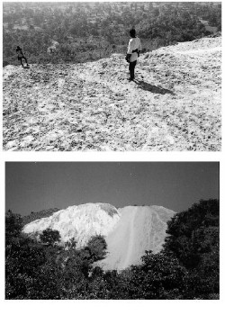
Mining has caused severe damage to the land resources of the area.
BY
DR. NITISH PRIYADARSHI
76,CIRCULAR ROAD,
RANCHI-834001
JHARKHAND
Introduction:
Mining is the extraction of valuable minerals or other geological materials from the earth, usually from an ore body, vein or (coal) seam. Materials recovered by mining include base metals, precious metals, iron, uranium, coal, diamonds, limestone, oil shale, rock salt and potash. Any material that cannot be grown through agricultural processes, or created artificially in a laboratory or factory, is usually mined. Mining in a wider sense comprises extraction of any non-renewable resource (e.g., petroleum, natural gas, or even water).
Mining of stone and metal has been done since pre-historic times. Modern mining processes involve prospecting for ore bodies, analysis of the profit potential of a proposed mine, extraction of the desired materials and finally reclamation of the land to prepare it for other uses once the mine is closed. The nature of mining processes creates a potential negative impact on the environment both during the mining operations and for years after the mine is closed. This impact has led to most of the world's nations adopting regulations to moderate the negative effects of mining operations. Safety has long been a concern as well, though modern practices have improved safety in mines significantly.
Mining is a very profitable business and it also creates employment opportunities. It benefits everyone including the government and that is why the mining industry is widely supported. There are several negative effects of mining for the environment.
To make mining possible, several forests are cleared and this leads to deforestation. The vegetation is cleared in order to build the mining facility and laying roads. Several organisms and animals live in these forests. With the deforestation, these organisms and animals lose their natural habitat. So, they start looking for a new habitat in order to survive. However, most organisms and animals do not respond very well this change and end up dying. The biodiversity is lost in this process. A number of smaller plants and creepers that grow with the support of the trees also die due to deforestation.
Every single forest in the world is a biosphere of its own. It is impossible to create a biosphere artificially as the various processes and inter-dependence of organisms is too complicated.
In addition, mining causes a lot of pollution as a lot of chemical waste incurred due to the various processed involved. This waste is released into water bodies, rivers and sea. The chemical composition of the soil also changes in the mining area. It becomes a desert-like environment where nothing grows.
Jharkhand is a state in eastern India. It was carved out of the southern part of Bihar on 15 November 2000. Jharkhand shares its border with the states of Bihar to the north, Uttar Pradesh and Chhattisgarh to the west, Orissa to the south, and West Bengal to the east of 28,833 sq mi (74,677 km²). The industrial city of Ranchi is its capital. Some of the other major cities and industrial centres are Jamshedpur, Dhanbad, Bokaro, Sindri, Deoghar, Hazaribagh, Lohardaga and Gumla.
The name "Jharkhand" comes from the Sanskrit word Jharikhanda, which is the ancient name of the region's dense forest.
Geography and climate
Most of the state lies on the Chota Nagpur Plateau, which is the source of the Koel, Damodar, Brahmani, Kharkai, and Subarnarekha rivers, whose upper watersheds lie within Jharkhand. Much of the state is still covered by forest. Forest preserves support populations of tigers and Asian Elephants.
Soil content of Jharkhand state mainly consist of soil formed from disintegration of rocks and stones, and soil composition is further divided into:
- Red soil, found mostly in the Damodar valley, and Rajmahal area
- Micacious soil (containing particles of mica), found in Koderma, Jhumeritilaiya, Barkagaon, and areas around the Mandar hill
- Sandy soil, generally found in Hazaribagh and Dhanbad
- Black soil, found in Rajmahal area
- Laterite soil, found in western part of Ranchi, Palamu, and parts of Santhal Parganas and Singhbhum
Jharkhand also has immense mineral resources: minerals ranging from (ranking in the country within bracket) from iron ore (1st), coal (3rd), copper ore (1st), mica (1st), bauxite (3rd), Manganese, limestone, china clay, fire clay, graphite (8th), kainite (1st), chromite (2nd), asbestos (1st), thorium (3rd), sillimanite, uranium (Jaduguda mines, Narwa Pahar) (1st) and even gold (Rakha mines) (6th) and silver and several other minerals. Large deposits of coal and iron ore support concentration of industry, in centers like Jamshedpur, Bokaro and Ranchi. Tata Steel, a S&P CNX 500 conglomerate has its corporate office in Jharkhand. It reported a gross income of Rs.204,910 million for 2005.
Jharkhand is known for its mineral resources. The state economy, industrialisation and employment mainly depend upon its development and utilisation. Several Steel industries, thermal power generation units and aluminium plant are based on iron, coal and bauxite available in the state. Limestone produced in the state is being utilised in the Cement plants located within and without the State.
Coal bed methane, rare earth minerals, precious and semi precious mineral are areas where immediate attention is required for investigation and exploration. The mineral resources of the state are as follows:
- Coal and Coal Bed Methane,
- Iron Ores, both Hematite & Magnetite
- Poly-metallic base metal ores like those of copper, lead zinc, silver & gold as well as separate deposits of gold.
- Bauxite & Lithomarge
- Limestone of various types
- Mica & associated precious & semi precious Minerals & gems,
- Graphite
- Pyroxinite /Amphibolites
- Soap stone / Pyrophyllite
- Uranium & other Radio-active Minerals
- Kyanite
- China Clay
- Dimensional, Decorative and Ornamental stones.
- There are immense possibilities of location the Platinum Group of Metals (PGMs), rare earths & Diamond in the State.
Effects of mining:
I. Forest area present in the present Jharkhand State:
Division & Village Wise Details of Jharkhand Forest Area
Sr No.
|
Name of Forest Division
|
Reserved Forest Area (ha)
|
Protected Forest Area (ha)
|
Unclassed Forest Area (ha)
|
Total Forest Area (ha)
|
1.
|
|
58081
|
46044
|
45
|
1041170
|
2.
|
|
3987
|
126661
|
-
|
130648
|
3.
|
|
549
|
123586
|
-
|
124135
|
4.
|
|
-
|
78705
|
-
|
78705
|
5.
|
|
20648
|
111736
|
-
|
132384
|
6.
|
|
81808
|
3988
|
86
|
85882
|
7.
|
|
58716
|
11258
|
68
|
70042
|
8.
|
|
50628
|
15816
|
98
|
66542
|
9.
|
|
31
|
50875
|
-
|
50906
|
10.
|
|
6486
|
61540
|
-
|
68026
|
11.
|
|
53050
|
51863
|
-
|
104913
|
12.
|
|
11742
|
80182
|
-
|
91924
|
13.
|
|
26290
|
73744
|
-
|
100034
|
14.
|
|
12101
|
118717
|
16
|
130834
|
15.
|
|
8776
|
113020
|
-
|
121796
|
16.
|
|
673
|
176524
|
340
|
177537
|
17.
|
|
1743
|
102055
|
-
|
103798
|
18.
|
Bokaro
|
-
|
51901
|
-
|
51901
|
19.
|
|
752
|
101828
|
-
|
102580
|
20.
|
|
-
|
93372
|
-
|
93372
|
21.
|
|
15630
|
73408
|
-
|
89038
|
22.
|
|
10825
|
15555
|
-
|
26380
|
23.
|
|
2866
|
73922
|
-
|
76788
|
24.
|
|
12803
|
135389
|
420
|
148612
|
25.
|
|
50
|
10471
|
2276
|
12797
|
26.
|
|
485
|
16318
|
-
|
16803
|
District-wise Forest Area in Hectares in Jharkhand
|
|
Name of the district
|
Geographical Area
|
Forest Area
|
Percent of Forest Area to Total Area
|
1
|
Dumka
|
551,800
|
160,989
|
29.2
|
2
|
Pakud
|
69,300
|
14,027
|
20.2
|
3
|
Godda
|
211,000
|
16,231
|
7.7
|
4
|
Sahebganj
|
340,600
|
8,254
|
2.4
|
5
|
Deoghar
|
247,900
|
23,546
|
9.5
|
6
|
Hazaribagh
|
504,900
|
242,904
|
48.1
|
7
|
Chatra
|
370,600
|
196,152
|
52.9
|
8
|
Koderma
|
241,000
|
89,038
|
36.9
|
9
|
Giridh
|
488,700
|
228,930
|
46.8
|
10
|
Bokaro
|
292,700
|
39,355
|
13.4
|
11
|
Dhanbad
|
207,400
|
26,380
|
12.7
|
12
|
Ranchi
|
757,400
|
179,454
|
23.7
|
13
|
Gumla
|
295,900
|
130,835
|
44.2
|
14
|
Lohardaga
|
773,300
|
36,573
|
4.7
|
15
|
Palamau
|
797,400
|
353,133
|
44.3
|
16
|
Garhwa
|
477,500
|
202,840
|
42.5
|
17
|
East Singhbhum
|
542,800
|
198,240
|
36.5
|
18
|
West Singhbhum
|
801,200
|
213,666
|
26.7
|
|
Total
|
7,971,400
|
2,360,547
|
29.6
|
I. Impact on forest:
The Website of the Jharkhand government says that forests in Jharkhand cover about 29 per cent of the state’s total geographical area. Feeding minerals to meet the nation’s insatiable appetite has taken its tall on the state- rampant mining for decades has turned large tracts of forests into wastelands. During the 80’s, coal companies acquired thousands of hectares of forests in Jharkhand for mining operation in Damodar valley. In Singhbhum district a similar devastation of forest lands happened for extracting iron ore. According to the Forest Survey of India’s State of Forest Report, during an assessment published in 1997, Jharkhand had 2.6 million ha of forest. In 1999, it had 2.2 million ha, a loss of 0.4 million ha of forest cover. The forest cover in the Damodar valley coalfield, once 65 per cent, stands at only 0.05 per cent today.
Saranda, once so dense that even the sun’s rays couldn’t penetrate it, has Asia’s largest Sal (Shorea robusta) forests and is an important elephant habitat. Today, uncontrolled mining for iron ore, both legal and illegal, is destroying not just the forest, but also the wildlife, apart from the livelihoods of the local tribal communities. The impact on the forests has been significant. According to the state of forest reports, between 1997 and 1999, about 3,200 ha of forest were lost in the Singhbhum region. Between 2001 and 2003 some 7,900 ha of dense forests were lost in the East and West Singhbhum districts. Saranda too has been affected, and further degradation will have serious consequences for its considerable biodiversity.
The Chiria mines in Saranda are believed to hold the largest deposits of iron ore in Asia. In the 85,000 ha of the Saranda division, 28 leases for iron ore mining exist in about 9,300 ha. The past few years have seen an increase in mining. Thousand of trucks jam the roads leading to the forest from Chaibasa past Noamundi, disturbing people and damaging ecology.
II. Different environmental pollution due to mining in Jharkhand State.
The Jharkhand region an account of its richness in some key ores and minerals and its abundance in cheap labour, thanks to its backwardness, otherwise, has been the site of a good many industrial establishment since pre-Independence days and that industrialization has brought with it concomitant ill effects the worst of which is the devastation of its environment. In the name of the development large forests have disappeared, tracts of inhabited land have gone under water. Water in the region around industrial areas has been polluted to an extent far exceeding the prescribed safety level.
In fact polluted water carried down the streams and rivers spreads mischief in distant areas also. Industrial pollution is already playing havoc with the life and health of the people of the region.
The natural wealth of this area contrasts vividly with the desperate poverty of the people who inhabit it. This region has been far the ages and the homeland of aboriginal races such as the Mundas, Asurs, Santhals, Oraons, Ho, Kharias etc. These indigenous groups have been the worst hit by the large scale exploitation of the natural resources of the region through the development of mines, industries and commercial exploitation of forests. The majority of them live in a state of semi-starvation through out the year. For centuries the indigenous people of Jharkhand lived in harmonious relationship with their environment. They have developed a culture which is closely related to nature. Since their lives are closely related to nature, any adverse impact on the environment in which they live will adversely affect their lives also, and vice-versa.
Mine areas often have a monochromatic appearance. Coal mining areas are depressingly black, iron ore town are red, ochre lends a yellow colour and limestone makes everything chalky white. Fine particles of the ore spread as a uniform layer of dust on every available surface in these areas.
The pervasiveness of dust is the strongest indication that mining is not a benign activity. Unless it is carefully planned and thoughtfully carried out, it can barren the land, pollute water, denude forests, defile the air and degrade the quality of life for people who live and work in the vicinity. Modern technology has enormously magnified our ability to extract minerals. In the process, it has also gravely threatened human lives and the environment.
In Jharkhand mining activity ranges from the small, completely manual stone quarries to mechanical mines. With increasing mechanization, mining equipment has grown larger and more powerful. Entire landscapes are altered in a relatively short period of time.
Mining ruins the land, water, forests and air. The loss or pollution of natural resources degrades the quality of human life in these areas. Increasingly, mineral-based production units like coal-fired power plants, steel plants and cement factories are located near the mines. A cluster of thermal power stations are planned near the major rivers of Jharkhand.
A precise estimate of the amount of agricultural land lost to mining is not readily available. Every mining enterprise, however, means the conversion of land to such purposes as roads, railways and ropeways for mineral transport, townships for housing miners and manager, infrastructure for administrative purposes, land for stockyard and preliminary processing operations. In effect, the total land affected by mining is many times larger than the simple lease area.
The large scale mining and allied activities going on in the Jharkhand region has caused severe damage to the land resources of the area. Vast areas of rich forests and agricultural land belonging to the indigenous people have been laid waste because of haphazard mining. Eliminating of existing vegetation and alteration of soil profile due to open cast mining operations, including shifting of overburden and reject dumps, have caused severe soil erosion and silting of adjoining courses and degraded the productive capacity of the lands in the area. Excessive underground mining, especially of coal, is causing subsidence of land in many areas as a result of which such lands have been rendered unsafe for habitation, agriculture and grazing. In 1980’s the coal mining industry became identified as a major cause of damage to the environment, with more than 80 sq. kms. of land being destroyed every year. Damage to land can also result from underground and stockyard fires in coal mining areas. Coal is normally accompanied by methane gas which is released when the coal is fractured and crushed during production. This gas can ignite spontaneously and it is extremely difficult to stop an underground coal seam from burning once it ignites. The normal practice is to seal off the tunnels where the fire has started so that it is starved of oxygen. This process may take years. In the Jharia coalfields, an underground fire has raged for more than 70 years, covering more than 2000 hectares, and has reportedly consumed 40 million tones of coking coal.
III. Soil erosion:
Mining exploration in Jharkhand State has been detrimental to the environment and has caused great soil erosion. Many peasants working the land are ignorant of the environmental impact that coal mining and other mining has. They are not aware of which techniques are best for the environment and can prevent soil erosion.
The main types of soil erosion in the mining areas, involving exogenic processes, are water erosion, wind erosion and man-induced erosion. Water erosion takes place in the rainy season which extends from June to September. Most soil loss in the areas is associated with water erosion, which includes splash erosion, surface erosion and channel erosion. Wind erosion, accompanied by sand storms, occasionally takes place in the dry season that extends from January to April. Man-induced erosion is primarily associated with accelerated erosion from the different mine workings.
Topography and soil cover has been changed or destroyed due to digging of opencast mines and dumping of overburden rock mass in the form of large heaps. Due to mass deforestation in the mining areas soils have been exposed for further erosion. Even the soils which were earlier removed for the mining and dumped elsewhere are exposed to further erosion and weathering.
IV. Formation of sinkholes and land subsidence:
Formation of sinkholes is not common in the mining areas of Jharkhand as the rock of these areas does not favor such phenomenon. Sinkholes are common where the rock below the land surface is limestone, carbonate rock, salt beds, or rocks that can naturally be dissolved by circulating ground water. As the rock dissolves, spaces and caverns develop underground. These sinkholes can be dramatic because the surface land usually stays intact until there is not enough support. Then a sudden collapse of the land surface can occur. Main problem is with land subsidence due to coal mining and underground mine fire.
When coal is extracted from underground mines, pillars of the mines are left to support the roof. Once the mine is exhausted, it should ideally be filled with sand to prevent the roof from caving in. but in most cases, this is not done. The mines are abandoned without being stabilised. Once the mining company abandons a mine, the powerful mining mafia takes over. The remaining mineral is illegally and unscientifically removed- even the pillars that support the roof are scraped away. Consequently, the roof weakens and gives way leading to loss of property and lives. Methane, a coal bed gas, can build up in abandoned mines, causing blasts that weaken the pillar and the roof and leading to a collapse.
The underground coal fire in Jharia town is increasing the threat of land subsidence, development of fissures, land collapse, formation of deep holes in the area. Many such incidents has been reported from Dhanbad and Jharia town from the last several years. A BCCL report has said that some of the fires had endangered production outlets, surface structures, railway lines, roads and drainage channels. In 2000, residents of Jharia town watched as the town’s temple snapped into two. The next moment, flames leapt out from underneath spewing noxious gas.
V. Loss of biodiversity:
The state of Jharkhand is a part of biodiversity rich regions of India because of its diverse physiographic and climatic conditions. The forests for the most conform to the type – Tropical Dry Deciduous Forest, Moist Deciduous Forest, Dry Peninsular Forest and Dry Mixed Deciduous Forest. The Forests of the state form catchments of the three main rivers — Koel, Damodar and Subernekha. State is also rich in wildlife. The species found represent a wide range of taxa for both plants and animals. This can be attributed to a terrain, variety of terrain and land forms (including water bodies).
Jharkhand forms part of the Chhotanagpur plateau province of the Deccan Peninsula and is very rich in natural resources. Nearly 50 % of the country’s minerals are located in the state — iron and coal being important among the main. About 30 % of its geographical area is covered with forests. Unfortunately the mineral map and the forests overlap for the major minerals. This is also a cause for concern in terms of biodiversity loss.
State of Jharkhand supports over 35 no. of tiger population and 700 of elephant population. The state has following matrix of large fauna :Tiger-34; Leopard-164; Elephant-772; Barking deer-3672; Cheetal-16384; Sambhar-3052; Chausingha-62; Common Langur-44920; Common Otter-98; Hare-2718; Hyena-613; Indian Bison-256; Indian Giant Squirrel-395; Jackal-559; Jungle Cat-11; Monkey-64685; Nilgai-1262; Pangolin-57; Porcupine-425; Sloth Bear-1808; Wild Boar-18550; Wild dog-537; Wolf-874; Dhanesh-56; Peafowl-5684; Jungle fowl-325. These figures give a good account of the faunal diversity of the state.
Mining activities has badly affected the biodiversity in the state, like soil cover, animals, birds, plant species etc. Unsustainable mining of natural resources have been a key factor for degradation of biodiversity. Vegetation in the forest areas have been under constant threat because of the unsustainable exploitation of the minerals. Forest officials of Saranda, Kolhan and Porhat have identified 237 forest compartments out of the total 289, covering 64,000 ha, as being very compact dense forest areas still untouched by mining. A survey by them showed that a small patch of 40 by 40 meters had about 30 plant species. These plant species are now under threat due to expansion of iron-ore mining. Mining activities, to some extent have affected the regeneration capacity of a few species such as Rouwolfia serpentina (Sarpagandha) and Gloriosa superba, Adhatoda versica, Achyrenthes aspera species.
Apart from the elephants, the forest of the Saranda area are home to the flying squirrel, four-horned antelope, sloth bear, leopard and deer. Their population are now decreasing.
In 2001, the district was declared an elephant reserve under the Central government’s Project Elephant, but the number of elephants has gone down from 424 in 2002 to 375in 2005. high iron –ore content in the rivers makes the water unfit for drinking and the noise of the trucks carrying ore scares elephants away from Saranda forest. The Manorharpur group of mines around Chiria transport their ore using roads going through the forest, which is also the main elephant migration route from Saranda to Kolhan. Clearances to several iron ore mining projects in the Sarai Kela Kharsawa Elephant Reserve seriously impacting the elephant habitat. North Karanpura coalfield valley forms a vital elephant corridor connecting the forests of Palamau to the Konar forests and is threatened by coalmining and allied activities. The expansion of the Ashoka coalmine in the valley was cleared in spite of its impact on the elephant corridor. Other projects undergoing clearance procedures in the same valley include new coal mines, thermal power projects and dams, destined to completely destroy this habitat.
Due to mining and decreasing forest cover area, reports of human-elephant conflicts have increased in the Jharkhand State.
The Koina and Karo rivers, which flow close to the mines, are full of residues which are directly released into these water bodies when ore is washed. These leaves the water and the river bank red. The result: Koina’s crocodile population has completely vanished and its other wildlife species, too, face extinction. River like Damodar has already been declared dead as it now does not support any life. Fishes are rarely found in this river. The villagers say that all their low-lying agricultural land in Karampada has been rendered unproductive by the red sludge. This is not only the case of iron ore mining, but in the mining areas like coal, bauxite, stone etc. have also spoiled the soil quality making unfit for any agricultural practice. Even most of the small community ponds and wells water are badly affected. Blasting in the mining areas has not only affected the rocks stability but also has affected the animals and birds, which are now very less seen in the mining areas. Mining has also changed the land use pattern.
Open cast mining is supposed to have the maximum impacts on the ecology. In this system land is required not only for mining area but also for dumping of overburden rock mass.
The impacts of stone mining in Ranchi district on ecology are mentioned below.
- Removal of vegetation (flora) has created pressure on fauna to leave the area required for mining and other purposes.
- Dust in atmosphere contributed to various activities may retard the growth of some of the plant species in surrounding areas.
- Noise and vibrations due to blasting, operation of the machines and transportation have driven away small animals including wild animals and birds from nearby forests.
- Due to mining top soil has been damaged.
- Topography and scenario has changed due to digging of open pits and dumping of overburden weathered rock mass in the form of large heaps.
VI. Impact on water:
It is now established that much of the groundwater pollution is caused by human activities, especially mining. Mining wastes pollute streams and rivers. Ore fines and toxic substances carried by rain water into nearby water courses, alters their chemistry and often makes the water unfit for human use. By locating mineral treatment facilities near the mines, water pollution problems get worse. These units use enormous quantities of water for washing the ores. The untreated effluents, slimes or tailings are often released into neighbouring streams or lakes. In many cases, the latter are the sources of water supply to the population.
Fig.1: Polluted Damodar river in North Karanpura Coalfield.
The large scale mining operations going on in the region have adversely affected groundwater table in many areas with the result that yield of water from the wells of adjoining villages has drastically reduced. Further, effluents discharged from mine sites have seriously polluted the streams and under groundwater of the area. Acid mine drainage, liquid effluents from coal handling plants, colliery workshops and mine sites and suspended solids from coal washeries have caused serious water pollution in the region, adversely affecting fish and aquatic life.
Damodar and Subernrekha river valley are the cradle of industrialization in Chotanagpur plateau region. Damodar is the most polluted amongst Indian rivers and ironically almost all polluting industries are government owned. About 130 million litre of industrial effluents and 65 million litre of untreated domestic water finds way to Damodar drainage system every day. A study of the area showed that one coal washery alone was discharging about 45 tonnes of fine coal into the Damodar every day and there are as many as eleven coal washeries in the region with an installed capacity of 20.52 million tones annually.
Fig.2: Flow of mining waste in Damodar River.
Today the picture of Damodar or Damuda, considered a sacred river by the local tribals, is quite like a sewage canal shrunken and filled with filth and rubbish, emanating obnoxious odors. Other major rivers of the region are also seriously polluted. The Karo river in the West Singhbhum is polluted with red oxide from the iron ore mines of Noamundi, Gua and Chiria. The Subernrekha shows a different type of pollution which is even more hazardous in nature. Metallic and dissolved toxic wastes from TISCO, Jamshedpur and HCL Ghatsila and radioactive wastes from the uranium mill and tailings ponds of the uranium corporation of India limited at Jaduguda flow into Subernrekha and its tributaries.
The release of different toxic metals like arsenic, mercury, chromium, nickel etc. from the coals and mine spoil heaps in Damodar and its tributaries have caused severe damage to water quality. Continuous dewatering by underground mines also affects water resources. These mines annually pump out millions of litres to drain mine galleries and release it into nearby water courses. This has caused flooding, silting, water logging and pollution in the mining areas of Jharkhand. They have also reduced the surrounding water table, and also reduced the available groundwater.
V. a. ARSENIC IN THE WATER OF JHARKHAND STATE- WITH SPECIAL REFERENCE TO NORTH KARANPURA COALFIELD.
Rivers flowing through the coal fields of Jharkhand have been reported to carry arsenic responsible for arsenic poisoning in downstream areas of West Bengal. The coal fields of Bachara and Piprawar areas of Jharkhand have contaminated the waters of the Damodar and its tributary, the Safi, causing problems in West Bengal. According to research done by the author, arsenic contamination arises mainly due to the dumping of waste from the coal mines along the river bed. Coals of the area mentioned contains sufficient amount of arsenic as described below.
The North Karanpura coalfield, a western most member in the east-west chain of the Damodar Valley Basin, forms a large expanse of coal bearing sediments spread over Hazaribag, Ranchi and Palamau districts of Jharkhand State. It covers a total area of around 1230sq. Km. For the arsenic study, samples from coal from Badam, Kerendari, KDH, Rohini, Dakra and Karkatta were analysed by the author. Molybdenum-blue Colorimetry was used as the chemical technique for arsenic determination as recommended by the International Standard Organisation. Concentration of arsenic in coal samples range from< 0.01 to 0.49ppm with an arithmetic mean of 0.15ppm. (Priyadarshi, 2004). Concentration of arsenic is low compared to most world coals. Average ash% is very high (up to 32.51%).
To understand the environmental impact of arsenic in coals of research area, water and sediments were analysed for arsenic concentration. Concentration were moderately high (2 ppm) in the sediments of local streams flowing through the coal mining area. Average concentration of arsenic in the sediments of mine water was 1.4 ppm. Though the concentration of arsenic is low in the surface water ( 0.001-0.002 ppm) it may still affect the local habitants especially during summer season when the consumption of water increases many folds. People of this area are consuming water from several years. Effects of arsenic will be there if the people of the area consume water containing arsenic for longer periods.
Real truth is that people of the area are ignorant about this toxicity. Few people know about this but due to lack of pure source of water they are helpless and are forced to depend on the contaminated water.
V. b. DAMODAR POLLUTION- A CASE STUDY:
One of the key pollution hotspots in Jharkhand as well as West Bengal is the Damodar valley. In fact, the Damodar, the ‘sorrow of Bengal’ has now a become a cause of sorrow for the entire nation. It is probably one of the most polluted rivers in the country today, thanks to mining operations and cal-based industries that have sprouted on its mineral-rich banks.
In a 1998 report, the CPCB classified the river in Dhanbad as ‘D’, or heavily polluted. It means the water here can only support some handy varieties of fish; it cannot be used for drinking or bathing. Many stretches of the Damodar and its tributaries resemble large drains carrying black, highly turbid water. The total suspended solid (TSS) count at most places along the upper and middle stretches of the river is 40-50 times higher than the permissible limit. For most part, between Rajrappa, in Hazaribagh district of Jharkhand, and Durgapur in West Bengal, the river carries a film of oil and grease from industrial effluents. Yet it continues to be the main source of water for many areas like North Karanpura to Jharia town.
Minerals mine rejects and toxic effluents are regularly washed into the river and its tributaries, which receive large quantities of suspended solids, dissolved solids sulphates and iron from the various mines. Mine rejects from open-cast mines find their way into the river and sometimes even choke the flow of the water. Drainage from active and abandoned mines also increases the pollution load.
Today the picture of Damodar or Damuda, considered a sacred river by the local tribals,in Jharkhand State of India is quite like a sewage canal shrunken and filled with filth and rubbish, emanating obnoxious odours. It is also contaminated with toxic metals like arsenic, mercury, flouride, and lead.
The Damodar river basin is a repository of approximately 46% of the Indian coal reserves. A high demographic and industrial expansion has taken place in last three decades in the region. Exploitation of coal by underground and open cast mining has lead to a great environmental threat in this area. Besides mining, coal based industries like coal washeries, coke oven plants, coal fired thermal power plants, steel plants and other related industries in the region also greatly impart towards degradation of the environmental quality vis-a-vis human health.
The most affected part of the natural resources is water in this region and thereby human health.
It is a small rainfed river (541 km long) originating from the Khamerpet hill (1068 m), near the trijunction of Palamau, Ranchi, and Hazaribag districts of Jharkhand. It flows through the cities Ramgarh, Dhanbad, Asansol, Durgapur, Bardwan and Howrah before ultimately joining the lower Ganga (Hooghly estuary) at Shayampur, 55 Km downstram of Howrah. The river is fed by a number of tributaries at different reaches, the principal ones being Jamunia, Bokaro, Konar, Safi, Bhera, Nalkari and Barakar. The total catchment area of the basin is about 23,170 km2; of this, three-fourths of the basin lies in Jharkhand and one-fourth in West Bengal. The major part of the rainfall (82%) occurs during the monsoon season with a few sporadic rains in winter. Damodar basin is an important coal bearing area and at least seven coal fields are located in this region.
High increase in the population i.e. from 5.0 million (1951) to 14.6 million (1991) has been observed during the last four decades which is the outcome of the heavy industrialization in this basin mainly in coal sector.
Mine water and runoff through overburden material of open cast mines also contribute towards pollution of nearby water resources of the area. Huge amount of overburden materials has been dumped on the bank of the river and its tributaries, which finally get spread in the rivers especially in the rainy season. These activities have resulted in the visible deterioration of the quality of the river water.
The large scale mining operations going on this region have also adversely affected ground water table in many areas with the result that yield of water from the wells of adjoining villages has drastically reduced. Further, effluents discharged from the mine sites have also seriously polluted the underground waters of the area.
Mine waters does not have acid mine drainage problem. It may be due to the fact that coal deposits of this basin are associated with minor amounts of pyrites and contain low sulfur. Iron content in these waters are found in the range of 1 to 6 mg/l. Though it is not alarming but it may be toxic to some aquatic species. Mine waters are generally bacterially contaminated which is clear from the value lying in the range of 100 to 2500.
Heavy metals like manganese, chromium, lead, arsenic, mercury, floride, cadmium, and copper are also found in the sediments and water of Damodar River and its tributaries like Safi, Nalkari, Bhera Rivers etc. Permian coal of this area contains all these toxic elements in considerable amount. Presence of lead is high above the alarming level i.e. 300 ppm (parts per million) in the coals of North Karanpura coal field.
The study warned that long term exposure to the lead present in that area might result in general wekness, anorexia, dyspepsia, metallic taste in the mouth, headache, drowsiness, high blood pressure and anaemia etc.
The Damodar sediments are deficient in calcium and magnesium and rich in potassium concentration. Titanium and iron are the dominant heavy metals followed by manganese, zinc, copper, chromium, lead, arsenic, and mercury. Other heavy metal like strontium shows more or less uniform concentration throughout the basin. Average concentration of strontium in the sediments of the river is 130 ppm. Silica is also high in the sediments of Damodar River and its tributary. The value is 28ppm.
Arsenic in the water ranges from 0.001 to 0.006 mg/l, mercury ranges from 0.0002 to 0.0004 mg/l, floride ranges from 1 to 3 mg/l.
It is obvious that due to extensive coal mining and vigorous growth of industries in this area water resources have been badly contaminated. The habitants have, however, been compromising by taking contaminated and sometimes polluted water, as there is no alternate source of drinking water. Thus, a sizeable populace suffers from water borne diseases. As per the health survey of about 3 lakh population, the most common diseases are dysentery, diarrhoea, skin infection, worm infection, jaundice, and typhoid. Dysentery and skin infections occur in high percentage in the area. If proper steps are not taken up the total population mostly tribals will be on the verge of extinction.
V. c. Subarnarekha River : Future is bleak
THE RIVER
Translated literally, Subarnarekha means 'streak of gold'. With a drainage area of 1.93 million ha this smallest of India's major inter-state river basins is a mute host to effluents from various uranium mining and processing units. While most rivers in the country are classified -- depending on the pollution load -- on a 'best designated use’ basis, the Subarnarekha defies any classification, as the existing parameters do not include radioactivity.
The rain-fed Subarnarekha originates 15 kms south of Ranchi on the Chhotanagpur plateau draining the states of Jharkhand, Orissa and West Bengal before entering the Bay of Bengal. The total length of the river is 450 kms and its important tributaries include the Raru, Kanchi, Karkari, Kharkai, Garra and Sankh rivers.
POLLUTION
The only streaks visible in the river are those of domestic, industrial or - incredibly - radioactive pollution. Subarnarekha's rich resource base has spelled doom for the basin. Between Mayurbhanj and Singhbhum districts, on the right banks of the Subarnarekha, are the country’s richest copper deposits. The proliferation of unplanned and unregulated mining and mineral processing industries has led to a devastating environmental degradation of the region. Improper mining practices have led to uncontrolled dumping of overburden (rock and soil extracted while mining) and mine tailings. During monsoons, this exposed earth flows into the river, increasing suspended solid and heavy metal load in the water, silting the dams and reservoirs.
Quarrying of construction material, such as granite, basalt, quartzite, dolerite, sandstone, limestone, dolomite, gravel, and even sand, has created vast stretches of wasteland in the river basin. Used and abandoned mines and quarries are a source of mineral wastewater and suspended solids.
Subarnarekha also has to bear radioactive waste that enters the river through seepage from tailing ponds of the Uranium Corporation of India at Jadugoda. It has three productive uranium mines, all within a 5 km radius: Jadugoda, Batin and Narwapahar.
The uranium ore is mined from underground and brought to the surface. Uranium is then extracted and processed to make 'yellow cake', an ingredient used to fuel nuclear plants. What is left behind are 'tailings' or effluents comprising radioactive products, which are mixed into slurry and pumped into tailing ponds. These ponds, each covering about 160 ha of land and about 30 metres deep are situated between adjoining villages.
No standards have been met in their construction and no measures taken to control the emissions. Overflow and seepage from the tailing ponds ultimately ends into the streams that feed Subarnarekha. These radiations pose the greatest threat to human health, as they harm living cells, often leading to genetic mutation, cancer and slow death.
Subarnarekha is the lifeline of tribal communities inhabiting the Chhotanagpur belt. Once these communities made a living out of the river's gold and fish. But today the polluted Subarnarekha has little to offer. Between 5,000-6,000 families of local tribals, including the fishing community of Dharas, residing on the riverbanks from Mango in Jamshedpur to Bharagora, have been affected by the river’s pollution.
Oil and slug deposits on the riverbed deter the growth of moss and fungi, vital food for fish, hindering the movement of Hilsa fish from the Bay of Bengal to Ghatsila. Even sweet water fish like sol die in large numbers during their breeding season. Reports reveal that villages in the region around Ghatsila such as Kalikapara, Royam, Jadugoda, Aminagar, Benasol and Baraghat are suffering from skin diseases. The male fertility rate has also declined. Unfortunately, people have not been active in protecting the river as yet, when they could do well and take an example from other social movements in other river basins.
GOVERNMENT ACTION
Government action has been all but absent in the basin. Although the National River Conservation Plan (NRCP) intends to clean domestic waste generated from Jamshedpur, Ranchi and Ghatsila, industrial pollution and runoff from mines is supposed to be tackled by respective State Pollution Control Boards.
As most industries and mines in this basin fall in Jharkhand state, the onus of checking pollution falls squarely on the state's Pollution Control Board, which has a particularly poor record in this regard. While the NRCP would definitely provide welcome amenities to the three earmarked towns, it would be premature to hope for an overall improvement in the quality of the Subarnarekha's water until the pollution control board carries out its duties.
Till then Subarnarekha, the ‘stream of gold’, will continue bearing the brunt of industrial indifference and government's neglect.
V. Ground water contamination:
Surface and underground mining activities can have direct and indirect impacts on the quantity, quality, and usability of groundwater supplies. The nature of the mining activity, geological substrata, and re-distribution of surface and subsurface materials will determine to a large degree how groundwater supplies will be impacted. As waters interact and alter the disturbed geologic materials, constituents such as salts, metals, trace elements, and/or organic compounds become mobilized. Once mobilized, the dissolved substances can leach into deep aquifers, resulting in groundwater quality impacts. In addition to concerns due to naturally occurring contaminants, mining activities may also contribute to groundwater pollution from leaking underground storage tanks, improper disposal of lubricants and solvents, contaminant spills as well as others. Ground water mainly of coal field areas are affected with nickel, copper, flouride, iron, zinc etc. Ground water in the Bauxite mining areas in Lohardaga district and iron ore mining areas in Singhbhum district are contaminated with iron.
V. a. Case study of Sukinda mines in neighboring Odisha State :
Sukinda chromite valley is one of the largest chromite deposits of the country and produces nearly 8% of chromite ore. It greatly contributes towards the economic development but at the same time deteriorates the natural environment. It is generally excavated by opencast mining method. In the Sukinda mining area, around 7.6 million tons of solid waste have been generated in the form of rejected minerals, overburden material/waste rock and sub-grade ore that may be resulting in environmental degradation, mainly causing lowering in the water table vis-à-vis deterioration in surface and ground water quality. The study conducted in and around one of the chromite mine of the valley reveals that the concentration of hexavalent chromium is found in the water samples of ground and surface water, mine effluents and seepage water. Hexavalent Chromium (Cr+6) have been found varying between 0.02 mg/l and 0.12 mg/l in mine effluents and 0.03-0.8 mg/l in shallow hand pumps and 0.05 and 1.22 mg/l in quarry seepage. The concentration of Cr+6 in Damsal nalah, the main surface water source in the area, is found varying between 0.03 mg/l and 0.14 mg/l and a increasing trend, which is in the downstream of mining activities, has been observed. Leachate study clearly shows that the soil lying in the vicinity of mine waste dump shows highest concentration of Cr+6.
VI. Effect of deteriorating environment on the communities residing
near mining areas:
The health hazards, degeneration of the health conditions of the people especially tribal women and children and water contamination is one of the most serious impacts of coal mining in Jharkhand and other mining in like stone mining, uranium mining etc.
VI. a. Case study of Coalfield:
Jharkhand is an area of abundant coalmines. Most of the coalmines are situated in Hazaribag, Chatra, Palamau, Rajmahal, Dhanbad and
Ranchi district. Mighty
Damodar River and its tributaries flow through these coalmines.
Jharkhand is the homeland of over a dozen indigenous communities, the major ones being the Santhals, the Mundas, the Oraons and the Hos. Most of their population is concentrated around the coal mines area.
Today, the picture of
Damodar River or Damuda, considered a sacred river by the local tribals, is quite like a sewage canal shrunken and filled with filth and rubbish, emanating obnoxious odours. This river once known as “
River of
Sorrow” for its seasonal ravages, has now turned into a “
River of Agony” from the environmental point of view.
Due to extensive coal mining and vigorous growth of industries in this area water resources have been badly contaminated. The habitants have, however, been compromising by taking contaminated and sometimes polluted water, as there is no alternative source of safe drinking water. Thus, a sizeable populace suffers from water borne diseases.
Besides mining, coal based industries like coal washeries, coke oven plants, coal fired thermal power plants, steel plants and other related industries in the region also greatly impart towards degradation of the environmental equality vis-a-vis human health.
The most affected part of the natural- resources is water in this region and thereby human health.
As per the heath survey of the local people, the most common diseases are dysentery, diarrhoea, skin infection, worm infection, jaundice, and typhoid. Dysentery and skin infections occur in high percentage in the area. If proper steps are not taken up the total population mostly tribals will be on the verge of extinction.
The Agaria tribe and other tribes that inhabit the coalfields of North Karanpura and East Parej,
India are faced with severe water contamination. In
East Parej, more than 80% of the community lives in poverty. Water for the community comes from hand pumps, dug wells, local streams and rivers. In some areas, mine water and river water is supplied through pipes. But most people are dependent on other sources - which are contaminated - for their water needs. Women and children in these areas have to travel more than 1 kilometer to fetch safe drinking water. Most villagers are left with no choice but to drink contaminated water. Dug wells are generally dried up during the summer and winter. Natural drainage is obstructed and diverted due to the expansion of mining. Villagers in these areas have no concept of how to preserve and purify rainwater.
Our longevity has reduced drastically, said Phulmani Kujur a 38 year old women of
East Parej coal field. We avoid taking bath everyday, there are a gap of 5 to 10 days, and do not drink water adequately due to water pollution, said Mahesh a Santhal Tribe of the same village.
Study reveals that average longevity of women in
East Parej coal field was found to be 45 and in most of the villages only one or two women had crossed the age of 60. In
North Karanpura coal field average longevity of male is 50 years and that of female is 45 years.
The number of deaths in a period of five years, in East Parej, also reveals shocking figures in Dudhmatia village: 6 out of average 80 people, in Agariatola village: 12 out of average 100 people, in Lapangtandi: 13 out of average 115 people, and in Ulhara: 9 (seven were children) out of average 80 people.
Villagers of Agariatola complain that their only source of drinking water has been damaged due to dumping of overburden and expansion of open cast mine. Villagers have no substitute but to drink the water of well provided by the miners which according to the villagers is not good in taste with foul smell and yellow colour. Villagers of Dudhmatia of the same coal field complained about foul smell present in the water of the only hand pump.
Average kilometers travel by the villagers to retrieve safe drinking water is 1 to 2 kilometers. In summer season we have to travel even more to have safe drinking water, alleged women of the affected areas. Sometimes organizations supply us the water through tankers but they are not sufficient, said villagers of the East Parej, North Karanpura and
South Karanpura coal field.
In the absence of even primary hospital and doctors in
East Parej (there is only one hospital run by Central Coalfields Limited, and is for the employees only) villagers are more dependent on the quacks as they are the regular visitor in the remote area.
Our children are the most affected due to living in such unhygienic conditions and filth, said villagers of the
North Karanpura coal field, one of the biggest coal mines of the area.
These are one of the most common situations in all the coal mines area of Jharkhand. Most of the population in North Karanpura coal field is dependent on
Safi River for drinking and other domestic purposes. This river is polluted because of the coalmines waste dumped along the banks of the river at different locations. Water of the area is contaminated with toxic metals like arsenic and mercury. Manganese has crossed the toxic level ( 3.6 milligram per liter against the permissible level of 0.5 mg/l.). According to WHO (World Health Organization) high manganese may affect with the symptoms like lethargy, increased muscle tone and mental disturbances.
Health survey done among the boys and girls in a local school it was found that majority of the children (both tribal and non-tribal) are lethargic may be due to inhalation of coal dust and consumption of contaminated water containing high manganese.
In the coal fields of Jharkhand most of the tribal women are employed in secondary activities such as loading and unloading of the coals. According to Chotanagpur Adivasi Sewa Samiti, a NGO working in Hazaribag district, constant contact with dust pollution and indirectly through contamination of water, air, etc. cause severe health hazard to women workers. As majority of the women workers are contract labourers, and paid on daily wage basis there is no economic security or compensation paid due to loss of workdays on account of health problems. Even during pregnancy women has to work in hazardous conditions amidst noise, air pollution that have adverse affects on their offspring.
Malaria is very common. It is found that there are numerous ditches, stagnant mine water, and open tanks breeding all the species mosquitoes. Majorities of the death were attributed to malaria. Next come the skin diseases such as eczema, rashes on the skin etc. it may be due to lack of care and cleanliness or due to the presence of nickel in drinking water. In some area like
East Parej high nickel (0.024 mg/l) have been reported by the author in the water. According to WHO nickel is a common skin allergen.
Many especially children of the coal fields suffer from dysentery and diarrhoea. According to the residents of the coal field, it is because of consuming contaminated water. About 60% of the local people are affected with seasonal allergies. Other diseases found were tuberculosis, headache, joints pain (pain begins at the age of 5 to 10 years, especially in
North Karanpura), gastric, cough and cold and asthma.
When asked from the villagers in East Parej and
North Karanpura about what do they think about future, they replied situation is going to worsen. They are not very confident about their life span. There is always a threat of displacement due to expansion of coal mining, which finally affects their longevity.
VI. b. Health impacts due to Uranium mining in Jadugoda:
Exposure to nuclear radiation is affecting the health of miners and villagers at Jadugoda in Singhbhum district in
Jharkhand State located in Eastern India, which is
India’s first uranium mining. Jadugoda, literally meaning "magic land", intrigues an outsider. The promise of magic enthralls; the mystery of the unknown attracts. But closeness reveals not innocence but an intention, dangerous and deliberate. According to different N.G.Os working among the tribal peoples of Singhbhum said the radiation may not bring sudden dramatic illness but slowly undermines the health of the people living in the surrounding villages. A health survey carried out by the State Health Department, to investigate the radiation effects, found 31 out of 712 people to be suffering from health disorders, which may be due to exposure to radiation.
Fig.3: Effect of radiation in Jadugoda.
The diseases include blood in cough, ulcer, swelling of bone joints, asthma, eye problems, etc.
Uranium for the country’s nuclear programme is mined here from three underground mines. A fourth mine was inaugurated in Turamdih in
Jamshedpur block in
Jharkhand State. UCIL is planning to open an other uranium mine at Bagjata panchayat in Mosabani.
Other than mines there are three tailing ponds; a fourth is in the offing. The contents of these dams are highly radioactive.
The people in the Jadugoda area are affected not only by radiation from tailing dams but also by lack of safety at the mines. Fatigue, lack of appetite, respiratory ailments are wide spread. Increases in miscarriages, impotency, infant mortality, Down’s syndrome, skeletal deformities and different skin diseases, children with big heads, thalassemia have been reported. The incidence of tuberculosis among the miners is very high.
One women of nearby Tilaitand village says that her husband deserted her because she could not get pregnant. Her villain: uranium mining. Other tribal women says her two children were born deformed at birth and were killed soon after. "The earth here is poisoned,'' she said.
Actually, the number of deformed children could have been much more. So many others either die or are killed soon after birth,'' said one social worker.
He admits that the deformities and diseases had been there even before the UCIL began mining here in 1967 but alleges that most of the victims are families of miners and workers at the tailing ponds where nuclear waste is deposited after enriched uranium is extracted from the ore.
Even though the retirement age is 60 years, rarely does one meet a uranium miner who has retired after serving his full term, alleged local N.G.O.s.
After the uranium ore is mined and processed here, the "yellow cake'" is sent to the Nuclear Fuel Complex in Hyderabad for enrichment. The waste is then brought back to the UCIL complex for further extraction, after which the dust is dumped, into the ponds.
Perhaps the major radio pollution in water is caused by uranium ore which contains 2 to 5 ponds of uraninite per tonne.
VI. c. A case study of Roro asbestos mining area:
To assess the impact of this abandoned chromite and asbestos waste, a fact-finding team (FFT) was constituted by the mines, minerals & People (mm &P) and Jharkhandis' Organisation for Human Rights J.O.H.A.R. in December 2002
Roro hills is located about 20 kilometers west of Chaibasa, the district headquarters of West Singhbum, Jharkhand.
The region has had an active history of mining operations for about seven decades starting with the mining of magnetite. Roro hills were mined for chromite and asbestos by major industrial houses like Tatas and Birlas. This hill range is contiguous to Jojohatu hill which is also mineralized with chromite. TISCO, which used to mine chromite from Roro, stopped operations before 1958 as they struck better deposits elsewhere. Asbestos mining was started by Hyderabad Asbestos Cement Products Ltd. after the area was abandoned by Tatas and Kesri, who were mining magnetite and chromite.
The highest elevation of the Roro hill is approximately 600 meters above the level of the plains where the settlements of Roro and Tilasud village are located. The entire hill range is well wooded.
Interview with ex-workers from the Roro mines from Roro and Tilaisud villages revealed that most of them had suffered or are suffering from low back pains, blindness or severely reduced vision, and respiratory illnesses. Several of those interviewed complained of coughing blood in sputum. FFT examined three chest radiographs (taken between 1998 and 2000) of workers who complained of chest pain and respiratory distress. The chest radiographs revealed several radio-opaque opacities in the middle and lower lobes of both lungs. These suggest some form of interstitial lung disease (pneumoconioses, pulmonary tuberculosis as comorbid conditions). Physical examinations were not carried out. Most patients described their conditions as tuberculosis but given their occupational histories, pneumoconiosis as either the principal diagnosis or a co morbid condition cannot be ruled out and merits further investigation. Several workers with history of working in the asbestos mines complained of low back pain. One worker, who had worked at the pumping station for over 10 years was suffering from epigastric hernia These findings suggest presence of ergonomic musculoskeletal disorders.
Several workers complained of significantly diminished visions. Some had cataracts, and evidence of eye injuries. A few workers complained of deafness subsequent to their exposure to loud sounds in the mines – reportedly secondary to exposure to loud noise with no protection of ears during blasting operations.
VI. d. Health impact due to stone mining in and around Ranchi city.
Opinions of miners on health condition: They always complain about cough and cold. Malaria is very common in the mining areas. In some mining areas like that of Ormanjhi block of Ranchi district, miners especially women miners complain that no preventive measures are taken against stone dust. Some of the women miners were found working in the dust without any nose mask inhaling all the dust. Situation is opposite for that of supervisors. They get rest for one month after every two months of working. Miners have to travel 15 to 20kms. to reach nearest hospital. Health study done on the workers working in stone mining areas in Daltonganj and Gumla districts of the State it was found that in Pulmonary Function test sixty percent of the people had an abnormal spirogram. Most had mild to moderate obstruction of airways while other workers with more than 10 years of experience had severe obstruction. Hemoglobin levels were found normal cases in all the cases where eosinophill were high in 85% of the cases as a result of high dust exposure levels.
VII. Major mining industries responsible for deterioration of Environment:
Jharkhand mines and minerals seem to be synonymous with the territory of Jharkhand. Jharkhand possesses a large reserve of mineral wealth within the territory: coal, iron ore, copper ore, bauxite, mica, graphite, kyanite, sillimanite, uranium, limestone, etc. form an integral part of mining industry in Jharkhand.
Among the above mentioned minerals, coal, bauxite, iron-ore, asbestos and uranium mining are more responsible for deterioration of local environment in Jharkhand State of India.
VIII. Various certifications for checking environmental standards in a mine:
Mining projects fall under Schedule-I of EIA Notification 1994 and are required to obtain
environmental clearance from Ministry of Environment and Forests (MOEF) as per the screening criterion. Forest clearance under Forest (Conservation) Act is also specifically required if the project involves the forest land. Mining projects being site specific projects, will also have to obtain separate site clearance from the Government as specified in the EIA Notification.
VIII. a. Environmental Policy/Legislation
Environment clearance of development projects including mining is done by the Government, with the following objectives:
Optimal utilisation of finite natural resources through use of better technologies and management packages, and increasing suitable remedial measures at the project formulation stage.
The Policy Statement of Pollution issued by the Ministry of Environment and Forests Govt. of India in 1992, provides instruments in the form of legislation and regulation, fiscal incentives, voluntary agreements, educational programmes and information campaigns in order to prevent, control and reduce environmental pollution. The establishment and functioning of any industry including mining will be governed by the following environmental acts/regulations besides the local zoning and land use laws of the States and Union Territories :
i) The Water (Prevention and Control of Pollution) Act, 1974 as amended from time to time (Water Act).
ii) The Water (Prevention and Control of Pollution) Cess Act, 1977, as amended (Water Cess Act)
iii) The Air (Prevention and Control of Pollution) Act, 1981 as amended (Air Act).
iv) The Environment (Protection) Act, 1986 (EPA)
v) The Wildlife (Protection) Act, 1972 as amended
vi) The Forest (Conservation) Act, 1980 as amended
vii) The Public Liability Insurance Act, 1991
viii) The Mines and Minerals (Regulation and Development) Act, 1957, as amended (MMRD Act)
ix) Circulars issued by the Director-General Mines Safety (DGMS).
Once the mining industry has been set up during the process of its life cycle, it is required to meet the standards of emissions, effluents and noise levels besides the compliance of other environmental acts/regulations including mining safety regulations. There also exists Guidelines for Integrating Environmental Concerns with Exploitation of Mineral Resources which identify some of the vital aspects relevant to environmental protection.
These guidelines highlight the salient aspects of the various problems and briefly indicate some of the steps that need to be incorporated during the planning and various stages of the mining operations. The need for evolving certain tolerance standards/limits by the appropriate agencies, has also been emphasised.
Components of Development and Associated Environmental Impacts in Mining projects are well known and major development components associated with these are tabled below :
* Land Acquisition * Site Development - Construction camp, creation of infrastructure including roads etc.
* Top soil removal and storage * Drilling and blasting
* Overburden removal and storage * Toxic waste treatment
* Mineral extraction * Mine water pumping.
* Disposal
* Mineral transport.
* Heavy earth moving machinery (HEMM) use and maintenance.
* Site restoration/reclamation - backfilling, treatment, spreading of top soil, revegetation.
* Mineral processing.
Mining projects, in general, give rise to potential environmental impacts and in scoping
exercise, the following environmental components (attributes) which are usually impacted as result of above listed activities must be considered :
- Landuse
- Landscape
- Socio-economic
- Water resources/hydrology
- Water quality
- Air and dust
- Noise and vibrations
- Ecology (flora & fauna)
- Risk/hazards
- Public health and safety
VIII. b. Anticipated Environmental Impacts
Anticipated (predicted) environmental impacts should be based on the experience gained in similar type of mines under similar conditions. Scientific data from the working mines to substantiate the anticipation shall also be furnished. The major anticipated impacts generally encountered in various components of development (as already listed in scoping) are summarised below.
Land use
The major direct impacts on existing land use during the pre-mining phase are the removal of vegetation and resettlement of displaced population. There may also be landuse changes with respect to agriculture, fisheries, recreation sites, housing, forestry areas etc. Land reclamation/restoration of mined out lands may give rise to enhanced beneficial land use.
Landscape
There exists major environment impacts due to landscape disruption particularly visuals
(unsighty huge dumps, voids, mine structures, subsidence, mine fires etc.). During mining and post mining phases drastic changes in landscape with landforms take place.
The major associated impacts are soil-erosion, loss of top soil, change in complete geology, creation of huge dumps & voids, disposal of wastes, deforestation etc Land reclamation/restoration may provide better landuse and landscape with considerations to environmental management
Socio-economic
The major beneficial impacts of mining projects are change in employment & income
opportunity, infrastructure, community development, communication, transport, educational, commercial, recreational and medical facilities. The major adverse impact, however, is the displacement and rehabilitation/resettlement of affected people including change in culture, heritage & related features. The crime and illicit activities also prop-up due to sudden economic development of the area.
Hydrology/water resources
The major adverse impacts are changes in ground water flow patterns, lowering of water
table, changes in the hydrodynamic conditions of river/underground recharge basings, reduction in volumes of subsurface discharge to water bodies/ rivers, disruption & diversion of water courses/drainages, contamination of water bodies, affecting the yield of water from bore wells and dugwells, land subsidence etc.
Water quality
The major impacts are water pollution due to erosion, oil & grease, contamination of water bodies due to discharge of mine water/effluents, pollution from domestic & sewage effluents, sedimentation of rivers and other stored water bodies, leachates from wash-off from dumps, solid waste disposal sites, broken rocks, toxic wastes, salinity from mine fires, acid mine drainage etc.
Air Quality
The major adverse impact is the high intensity of dust nuisance problems such as visuals,
soiling and degradation of materials etc. The major sources activities of dust emissions are drilling &
blasting, overburden removal, haul roads, coal extraction, transportation, reclamation activities and
also erosion from dumps, coal yards, waste disposal areas.
Other impacts are gaseous emissions, exhaust from HEMM & other transport vehicles.
Noise and Vibrations
The major adverse impacts during pre-mining and mining phases are generation of obnoxious levels of noise & vibrations which also spread in neighbouring communities. The other impacts are occupational health hazards, damage to structures, disruption in wildlife etc.
Ecology (flora & fauna)
The major adverse impacts due to pre-mining and mining phases are loss of habitat,
biodiversity, rare flora & fauna, fisheries & other aquatic life, migration of wildlife and overall disruption of the ecology of the area. During post-mining phase after land restoration, ecology may effectively improve.
Risks and hazards
Risks and hazards arise mainly from blasting and mine occupational activities and are well established. Blasting may effect the mine workers as well as people residing in the vicinity of mine and dependent upon the type & quantity of explosives used, pit geology, topography and confinement of the blast. Various respirable diseases due to occupational hazards associated with mining operations are quite infamous. Workers are also put in various risky jobs in typified mine works.
There also exists risks and hazards of mine accidents (roof fall, explosions, inundations, rock bursts etc.). Vibrations and fly rock as a result of blasting and rock fragmentation give rise to serious risk of accidents and damage to structures.
Significance of Impacts
After anticipation (prediction) of impacts, it is necessary to assess their significance. The
assessment needs to reflect the particular local characteristics of the area proposed for the mining project. Some of the issues associated with the mining projects may have profound impacts on local people and their views need to be considered to avoid complications regarding the R&R package, employment opportunities, public health & safety etc. Criteria which are useful in assessment of impacts may be based on the following :
• legal requirements/environmental standards
• guidelines covering the design and construction of new infrastructure, R&R packages,
compensation etc.
• need for providing mitigation measures including guidelines for the reclamation of mined out areas, dumps and other disused areas.
Specific evaluation criteria may be necessary for a specific mining project taking into account the nature of the impacts and the receptors. An environmental impact matrix reflecting the significance and magnitude of anticipated environmental impacts during pre-mining and mining (operation) phases with respect to a mining project in eastern India is given in Annexure 2. An environmental management plan specifying the specific safeguards/mitigation measures in view of this is required
VIII. c. Proposed Environmental Safeguards/Mitigation Measures
While providing for the environmental safeguards to mitigate environmental impacts, care should be taken to provide details about the similar kind of measures adapted in other projects. The degree of success of these measures achieved in other projects should also be considered in determining the utility of proposed safeguards/mitigation measures. These are summarised below.
Land Use/Landscape
Mitigation measures concerning landuse include following aspects :
• To ensure landuse changes happen in an optimal way so that impacts are minimised and land is reclaimed as soon as possible with predetermined land use patterns and landscape considerations.
• To minimise the impacts on the local population with provision of environmental benefits to local people Year-wise Reclamation Plan is to be prepared while considering the above aspects and consists of
• Top soil removal and conservation (bunds etc)
• Overburden analysis and selective procedures for handling requirements including ripping & regradation
• Phased plans for overburden dump construction considering the stability, slope,
contouring/gradient landscape factors
Plant materials selection for reclamation
Phased plans for plant material establishment
Nursery production procedures for plant materials
However, there is little that can help to prevent the damage to landscape during mining phase.
However, during post-mining phase/restoration process, proper afforestation with layout of rehabilitation measures such as recreational will help in improving the aesthetics and landscape.
Water Resources
Due to mining operations the major impact is lowering of water table and reduction in overall water quantity. Provision for creation of stored water bodies be made by putting up the pumped out mine water in these. This can provide excellent recharging facility and ensure proper quantity of available water in league with National Water Policy. Wherever possible grouting may be done to prevent particular water bodies.
Sedimentation can be checked by providing various engineering measures and stabilising
dumps etc.
Water Quality
The major mitigation measures are listed below:
• Overburden run-off collection and treatment with subsequent sediment control
• Oil & grease traps/separators
• Collection/storage of leachates, seepages, wash-offs with subsequent treatment
• Proper sanitation and provision of domestic and sewage effluents treatment
• Treatment of mine water discharges.
Air Quality
Following measures generally, are practiced for prevention and control of air pollution in
mining areas:
• Dust suppression through heavy dust sprinklers/road watering trucks at various sensitive
points such as haul roads, mineral handling plants, crushing and screening plants etc.
• Dust extraction facilities are to be provided with HEMM, crushing, screening and mineral handling plants.
• Water sprays, hoods, dust collectors are to be used to control dusts from drilling.
• Measures such as adoption of hoods a transfer points, proper design of chutes, vulcanizing conveyer belt joints, underbelt cleaning devices apart from dust suppression and/or dust extraction system for conveyers are usually introduced to minimise dust pollution.
• Mineral handling plants are to be covered with proper enclosures
• Transportation (trucks/dumpers & railway wagons) are to be properly covered and leak proof. Suitable spraying agents to be sprinkled to prevent dusts from being airborne.
• Consolidation of haul roads & other roads should be sprayed with suitable chemical additives for effective check of dust emissions.
• Stabilisation through vegetation at various critical dust generating points/dumps.
Noise and Vibrations
The nature of mining activities is such that noise & vibrations can not be eliminated. Various measures to prevent noise pollution are:
• Provision of ear plugs and ear muffs to reduce noise level exposure.
• Use of noise abatement paddings in fixed plant installations
• Use of silencers/mufflers in HEMM, noise insulating enclosures.
• Location of residential/resettlement colonies away from noise generating sources.
Vibrations can be checked/prevented as under :
• Buildings likely to be affected due to vibrations should be identified and protected by
trenching or other appropriate measures to minimise vibration effects.
• Control of ground movement due to vibration can be achieved by avoiding over-charging, use of delays and improved blasting technology. Due regard must be paid to vibration transmission properties of geological formations and terrain stability (tectonism, seismiciy etc)
• Vibrations due to mobile plants and equipment can be minimised by modernisation and
proper maintenance.
Ecology
The methods to safeguard ecological impacts include avoiding areas of high ecological values for siting various mining infrastructure dumps, disposal sites etc.
• Providing environmental (wildlife) corridoors to link adjacent habitat where mining is to be carried out in such sensitive afforested areas.
• Suitable design of greenbelts/shelter beds with selected species should be provided which can also respond to attenuate dust, gaseous emissions and noise levels.
Due to the nature of mining and occurrence of typical mineral deposits it is not possible to restore the entire ecological scenario in the mining areas.
Monitoring
Each mining company including at project level usually identify within its setup a
Department/Section/Cell with trained personnel to take up the model responsibility of environmental
management as required for planning and implementation of the projects. The purpose of the monitoring is :
• to ensure that no impacts are in excess of standards
• to check the predictions made in EIA
• to facilitate identification of any unidentified impacts and make provisions for their
mitigation.
A monitoring and feedback mechanism is required to effectively implement and monitor
environmental management plan. This will ensure proper implementation of mitigation measures proposed and also to effect mid-course corrections, if required monitoring is required during construction (pre-mining), operation (mining) and restoration (post-mining) phases. Monitoring should be carried out on regular basis using standard methods of various environmental attributes by suitably qualified personnel. However, there is a strong need for evolving the environmental management systems to ensure effective monitoring, environmental compliance and interaction with concerned and support groups and also for best practice environmental management, as per ISO :14000
Reference:
Ambient SPM concentration around rock crushing industries of Daltonganj, Gumla towns, Jharkhand and associated health effects. 2003, by D. Mishra, D. K. Bhattacharya and V. C. Barla. In Environmental Management in Mines, edited by B. K. Shrivastva, R. Kumar and A. Jamal.
Priyadarshi, N.: Arsenic in Damodar poisoning West Bengal. Indian Express, July 12, 1998.
Priyadarshi, N. 2004. Distribution of arsenic in Permian Coals of North Karanpura coalfield, Jharkhand. Jour. Geol. Soc. India, 63, 533-536.
Areeparampil, M.SJ. (!995). Displacement due to mining in Jharkhand, in Mining Environment, B.D. Bhagat and D.N. Thakur (Eds.), Oxford & IBH Publishing Co. Pvt. Ltd., New Delhi.
Singh, J. (1985), Upper Damodar Valley: A study in Settlement Geography, Inter-India Publication, New Delhi.
Citizens report- Rich lands and poor people (2008), Centre for Science and Environment, New Delhi.
http://www.jharkhandforest.com/forest_area.html